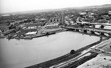
11th Street Bridges
[7][8] The Eastern Branch Bridge was blown up and partially burned by retreating American soldiers in August 1814 during the War of 1812.
[7] In 1820, the privately owned "Upper Navy Yard Bridge" was built over the Anacostia River at 11th Street SE.
The main girders are riveted and welded, and both have reinforced wall type piers with granite facing, supported by steel H piles.
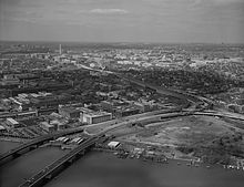
[14] In 1956, federal and regional transportation planners proposed an Inner Loop Expressway, one of three circumferential beltways for the District of Columbia.
[25] On-ramps from Anacostia to the northbound span of the 11th Street Bridges were closed on December 20, 2009, for five and a half hours after heavy snow blocked the approaches during the North American blizzard of 2009, with the snow removal disrupting automobile traffic and forcing the temporary closure of several Metrobus routes which use the bridge.
[33] Joined by D.C. Council member Marion Barry, the protesters said too few individuals from the Anacostia area (which suffers from a 30 percent unemployment rate) had been considered for employment or hired by Skanska/Facchina, the joint-venture construction company building the bridges.
[33] Skanska/Facchina vice president Brook Brookshire denied the accusations, noting that 51 percent of the new hires were D.C. residents, the company had engaged in extensive outreach to the unemployed, and that the company had worked with local jobs organizations, the D.C. Department of Employment Services, and the D.C. Department of Transportation to find workers for the project.
[34] Brookshire also said the company had provided training to unskilled workers to enable them to work on the project and find careers in the construction industry.
[36] The non-local spans were finished months ahead of schedule, and D.C. Mayor Vincent C. Gray held a ribbon-cutting ceremony on December 16, 2011, to open the two bridges connecting I-295 with the Anacostia Freeway.
Officials in December 2011 predicted the local-only span, which was intended to carry not only automobiles but also include bicycle and pedestrian lanes, would open in the summer of 2012.
[40] In March 2012, DDOT also closed the ramp leading from I-695 to the 11th Street Bridges so that new approaches and connections to the new spans could be constructed.
[41] Ten Metrobus routes were rerouted due to the span closure, adding significant travel times for Anacostia commuters.
[42] Motorists attempting to reach Anacostia were forced to use one of three time-consuming alternative routes: exit I-395 at the Sixth Street SE ramp, travel through local streets, and use an on-ramp next to the Washington Navy Yard to access the undemolished old outbound bridge; continue onto I-295 and exit at Howard Road SE; exit onto South Capitol Street and take the Frederick Douglass Bridge; or continue east to the John Philip Sousa Bridge.
DDOT also admitted that Anacostia residents traveling into the city would not have direct access to M Street as originally planned.
[43] Since the cancellation of the Inner Loop Expressway, motorists wanting to access the Baltimore–Washington Parkway or U.S. Route 50 in Maryland (the John Hanson Highway) would often travel Interstate 695 to Barney Circle, wait at the traffic light there, use Pennsylvania Avenue to cross the nearby Sousa Bridge, wait at a traffic light on the southwestern terminus of the bridge, and make a left turn against oncoming traffic to access a narrow and dangerous ramp that led to northbound D.C. Route 295 (the Anacostia Freeway).
[47] The reconstruction project, estimated to take 18 to 24 months, raised the roadway 20 feet (6.1 m) to bring it level with the grade of the surrounding streets.
[48] The six-lane former highway began to be turned into a four-lane grand boulevard with a landscaped median and pedestrian nature trail.
[53] The local span of the new 11th Street Bridges was designed to accommodate a lane for the trolley cars of the city's emerging DC Streetcar tram system.
[55][56] To help fund construction of the Anacostia Line, DDOT proposed transferring $10 million from demolition of the 11th Street Bridges, but put that plan on hold due to delays in the streetcar project.
DDOT had applied for an $18 million Transportation Investment Generating Economic Recovery (TIGER) grant from the United States Department of Transportation to build the trolley bed and lay tracks along the local span, but the federal agency denied the application in October 2010.
[60] However, in October 2009, construction began on the new United States Department of Homeland Security (DHS) headquarters on what used to be the west campus of St. Elizabeths Hospital.
DDOT and the Federal Transit Administration began holding a series of public meetings to determine how to link the 11th Street Bridges with DHS.
[63] In January 2012 the fourth public meeting narrowed the routes down to four alternatives for linking the Anacostia Metro station to the bridges.
[64] DDOT originally planned to tear down the spans of the existing 11th Street Bridges, but leave the piers standing.
At both ends of the local-only span, the city also proposed building fishing piers, which would extend into the Anacostia River.
[67] The Office of Planning's initial concept proposed building a new 925-foot (282 m) superstructure on the piers, complete with utilities (electricity, natural gas, sewage, fresh water).
[65] City planners argued the concept would connect parks and trails along both sides of the Anacostia River, provide a "destination attraction" in the city's impoverished Southeast which could enhance retail sales as well as economic development in the area, and provide badly needed outdoor recreational facilities to residents of the Anacostia neighborhood.
[70] But Beth Purcell, president of the Capitol Hill Restoration Society, called the plan "bizarre" and argued that the city should not delay construction of the overlooks and fishing piers in favor of an unstudied design proposal with no funding.
Writing for The Washington Post, he pointed out that the "recreation bridge" connected two neighborhoods of only moderate population density, and was not easily accessed from either side of the river.