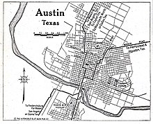
1928 Austin city plan
[2] Waller and fellow surveyors laid out a grid plan fourteen city blocks wide, with a central four-block town square meant for the Texas Capitol.
[3]: 8–11 From the Civil War to the early 1900s, most of Austin's African American population lived in a number of freedmen communities distributed across the city, such as Clarksville and Wheatville.
[8]: 42 Another section called for the creation of a municipal airport, suggesting that it be built in southeast Austin on what is now the neighborhood of Travis Heights.
[6] Later in 1928, Austin voters approved a municipal bond package providing $4.5 million (equivalent to $80,000,000 in 2023) in funds to implement many of the city plan's recommendations.
[10] Though the vast majority of its contents dealt with the sorts of city planning issues that still confront Austin today (transportation, utilities, parks, schools),[6] the 1928 master plan is mainly remembered today for its role in establishing East Avenue/Interstate 35 as the dividing line between the majority-white central city and the majority-black district of East Austin.
[5] This pattern of racial housing segregation persists in Austin to the present day, though its effects have been eroded by subsequent court rulings and legislation from the Civil Rights Era.
The city excluded Wheatville from essential amenities such as trash collection, electricity, paved streets, and water services.
These discriminatory practices, combined with the influx of students and rising property prices, led many Black residents to leave Wheatville in search of better living conditions elsewhere, particularly in East Austin.