1964 Zagreb flood
High rainfall upriver caused rivers and streams in the Sava catchment basin to swell and spill over their banks in many places throughout Slovenia and northern Croatia.
Regulation of the Sava and its tributaries upriver from Zagreb cut off many natural detention basins, such as fields and pastures, which caused water to pile up ahead of the city.
The railway embankment and sandbag dykes successfully protected the northern and eastern part of the floodplain, and Donji grad and much of Peščenica were spared.
[5] Due to the low permeability of the hilly and mountainous terrain of Slovenia and northwest Croatia, the river exhibits a high seasonal flow variability, exacerbating the risk of flooding.
The Medveščak stream caused the city's deadliest natural disaster in 1651, when a flash flood swept away houses in Tkalčićeva Street, killing 52 people.
[15] The twin cities of Kaptol and Gradec, which are located at the lower end of Medvednica foothills and form the core of modern-day Zagreb together with the adjacent Donji grad, controlled land in the floodplain on both banks of the Sava as early as the 13th century.
[16] The city was slow to expand since even the Donji grad area, which lies on the northern edge of the plain, was prone to flooding until it was artificially raised around the beginning of the 20th century.
[22] By 1929 the central part of the suburbs was protected by an embankment,[19] which was in the 1930s extended away from the river to Radnička Road in Peščenica in the east, and along the Črnomerec stream up to the northern border of Trešnjevka in the west.
[38] This rise was likely accelerated by the saturation of the drainage basin by moderate rainfall the previous week, which had produced a smaller water wave that ended up cresting at 304 cm (10 ft 0 in) in Zagreb on 16 October.
The Tempo quarry near modern-day Lake Jarun was inundated around 15:30, when water breached makeshift dykes, and the company's cement supply was flooded.
This area included the neighbourhoods of Jarun and Knežija, west of Savska Road and south of today's Ljubljana Avenue (then part of the Ljubljana–Zagreb–Belgrade Highway, running east–west through Zagreb).
[48] Under the railway overpass near Stadion Kranjčevićeva, where the sandbags were stacked to protect the city centre, the water reached the height of the traffic signs.
The neighbouring Nada Dimić textile factory was saved by its workers, who plugged all sewer drains with sandbags in time to stop the flood.
[57][58] Water then began piling up against Radnička Road as the embankment of the rail spur for the heat plant prevented outflow from the Savica oxbow.
[48] On the right bank of the Sava, flooding was extensive in rural areas, reaching past Karlovac Road near Samobor and Lučko, upriver from Zagreb.
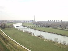
[1] Channelling and embankments built on the Sava and its tributaries Sutla and Krapina effectively fenced off farmland, marshes and open fields, which had previously functioned as natural detention basins that flattened the flood wave.
[69] In Zagorje, the River Sutla (Slovene: Sotla), a left tributary of the Sava, washed out the railway in Kumrovec and stopped road traffic in Klanjec.
[84] Many residents sent their children away with rescue services, planning to wait out the flood and take care of their possessions, only to find themselves trapped in attics and on the rooftops of their single-storey and two-storey homes as the water kept rising.
[60] In the later days of the flood, residents who successfully took shelter at the upper floors of taller buildings were also evacuated, as they were without access to tap water and sanitation.
[54] In Zagreb's surroundings, around 30,000 ha (74,000 acres) of farmland was underwater in the municipalities of Samobor, Zaprešić, Velika Gorica, Dugo Selo and Sesvete.
[100] Some factories endangered by the Sava and its tributaries outside Zagreb proper included Serum Zavod (today Pliva) in Kalinovica,[101] Žumberak in Savski Marof, Jugomontaža in Brdovec, and Karbon [sh; hr] and Jugokeramika in the Zaprešić area.
[104] Consequently, they were immediately under threat from the floodwaters which began entering the building at 03:00 on 26 October, and in several hours overcame impromptu defences and flooded most of the equipment, causing around 1 billion dinars in damages.
[79][59][111] The proceeds of the NK Zagreb – A.S. Roma association football match held on 28 October for the 1964–65 Inter-Cities Fairs Cup were donated toward recovery from the flood.
[114][115] The SR Croatia Red Cross set up camp beds in Zagreb hospitals, and distributed clothing, blankets and some food supplies to the evacuees.
[121] Many buildings which were found fit for repairs were temporarily uninhabitable, as their waterlogged walls and floors made it impossible to dry and heat them for the incoming winter.
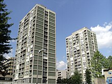
[108] The recovery efforts, organised by Mayor Pero Pirker, led to the creation of a number of new neighbourhoods to replace and compensate for lost housing.
[150] The 1990 Sava Valley flood broke the 1933 high water mark in Radeče by another 54 cm (21 in) and caused much damage in Zagreb's surroundings, especially the area of Samobor and Zaprešić, but the city proper was spared, except for the (by then already decommissioned) Jakuševec Bridge, which was carried away by the river current.
[157] The issue of river profile changes due to sediment transport was intended to be solved by a series of hydroelectric dams between Podsused and Rugvica,[158] but these plans were not carried out.
[106] Filmmaker Bogdan Žižić made his directorial debut with Poplava (The Flood), a 1964 short documentary film created out of television footage of the events.
[77] The recovery of the city from the catastrophe made Pirker a highly popular mayor, and he continued his career at the national level, but fell into oblivion following the suppression of the Croatian Spring in 1971 and his death from cancer the next year.