Aigüestortes i Estany de Sant Maurici National Park
The park's name in Catalan is Aigüestortes i Estany de Sant Maurici, freely translated as "The winding streams and St. Maurice lake".
The fauna includes Pyrenean chamois, brown bear, marmot, ermine, roe deer, among other mammals and numerous birds (black woodpecker, common crossbill, lammergeier, golden eagle).
The core area is located in the comarques of Pallars Sobirà and Alta Ribagorça, and includes the main entrances of the park: On the west side, from the village of Boí, is the Aigüestortes plain.
Aigüestortes means "winding waters" and is largely flat which allows the river to meander and flow slowly.
To the east, near the village of Espot, is Sant Maurici lake, one of the most famous of the region, from where one can see the spectacular twin peaks of the Encantats.
This area also includes part of the municipalities of Vielha e Mijaran and Naut Aran in the Val d'Aran; Vilaller and Vall de Boí in the Alta Ribagorça; La Torre de Cabdella in the Pallars Jussà; and Espot, Alt Àneu, Esterri d'Àneu, La Guingueta d'Àneu and Sort in the Pallars Sobirà.
Inside the borders of the national park, there is no record of stable human habitation during this time, but recent archeological studies have found evidence of temporary settlements from 8,500 years ago in the Neolithic Age.
During the 19th century, the high Pyrenees became more populated, fueled by strong demand for natural resources with intense forestry, farming, and fishing.
In 1997, after litigation between Catalan and Spanish laws, it was agreed that autonomous regions can also take part in the management of the national parks.
However, former meadow and pastureland which have been historically exploited by humans are now typically occupied with grasslands and shrubs, dominated by common box Buxus sempervirens or secondary forests with Scots pine Pinus sylvestris.
Most representative mammal species are Pyrenean chamois (Rupicapra pyrenaica), brown bear (Ursus arctos), stoat (Mustela erminea), alpine marmot (Marmota marmota) (which is not native), fallow deer (Dama dama) and roe deer (Capreolus capreolus) which were also introduced in the national park during the second half of the 20th century.
The lakes, the waterfalls, the sharpened peaks, the vertiginous ridges and the U-shaped valleys are the footprints of the erosive action of those ancient glaciers.
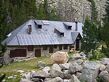
Senet has an information center explaining the evolution of the park in the relation between humans and animals: a history about competition, exploitation and good fellowship.
During summer months a little information centre is open in Estany Gento, and a cable railway runs in the higher valley of Torre de Cabdella.
Walking access is free, but it is forbidden to collect any rocks, plants, flowers or mushrooms, and hunting and fishing is prohibited.
In Espot or Boí, walkers can hire 4x4 taxis which can transport them to a number of popular locations within the park, such as the Aigüestortes plain or Sant Maurici lake.
At the Vall Fosca, the southern entrance of the park, a cableway connects Sallente with estany Gento, where some nice day walks begin.
Some of them are: A very interesting tour for several days: Other mountain activities as rock climbing, alpinism, snowshoeing or backcountry skiing are also allowed (with some regulations) in the national park.
Cycling is only allowed on paved routes inside the park (just to Sant Maurici Lake or Aigüestortes plain) and is strictly regulated.
There is a rich architectural heritage in the region, including the Catalan Romanesque churches of the Vall de Boí.