Al Rayyan
Its primary settlement is the city of the same name, which occupies the entire eastern section and is a part of the Doha Metropolitan Area.
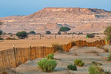
This name was bestowed upon it due to its low elevation, allowing it to act as a flood plain and provide a sustained supply of water to the numerous plants that grew within its boundaries.
It is divided into two main sections; the west consisting of scattered rural settlements, farms and open desert, and the east comprising the city of Al Rayyan, an urban offshoot of Metropolitan Doha's westward growth.
Instead, nomadic herding of livestock and small-scale crop cultivation comprised the livelihoods of its past inhabitants.
According to government statistics recorded when Al-Shahaniya was still integrated into Al Rayyan, the municipality accounted for the majority of Qatar's farming activities.
There were 499 farms occupying 17,136 hectares, most of which (256) were involved in cultivating crops, 234 of which were mixed operations, 8 of which raised livestock, and 1 categorized as "other".
[16] According to the 2015 census conducted by the Ministry of Municipality and Environment, there were a total of 199 schools located in Al Rayyan at that time.
[18] Several schools have transferred to Al Rayyan from Doha as a result of lower operating costs and closer proximity to students.
[23] Aspetar, a specialised orthopaedic and sports medicine hospital, is found in the Aspire Zone in the Baaya district.
[26] Public transport in the municipality is generally poor and not used by most of its residents due to a lack of facilities at the central station and inconsistent headway.
[29] Salwa Road runs from Doha proper to Abu Samra on the Qatar-Saudi border for roughly 95 km.
[2] It is an important commercial artery in the municipality's eastern extremity, hosting car showrooms, superstores and outlet stores.
It runs through the following districts in Al Rayyan, sorted from east to west and north to south:[2] The Orbital Highway is Qatar's longest road at 195 km.
[32] Created to bypass the traffic congestion in Doha, the highway begins in Mesaieed and ends in the north at Ras Laffan.
[33] On 9 December 2015, the Ministry of Municipality and Environment inaugurated a government services complex in Al Rayyan City.
[2] On 5 June 2017, when a quartet composed of Saudi Arabia, the United Arab Emirates, Bahrain and Egypt severed ties with Qatar, the border crossing was shut down.
It was reported that in 2010, construction accounted for the largest sector of the workforce at 74,00, with manufacturing coming second at 15,500, followed by transportation and storage (7,900) and education (7,800).