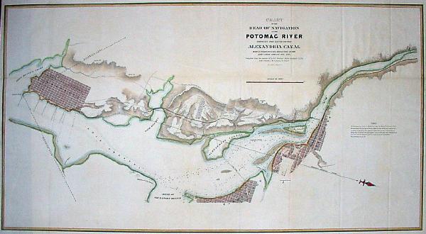
Alexandria Canal (Virginia)
The boats would then continue their trips downstream on a canal on the southwest side of the Potomac until they reached Alexandria's seaport.
Ten years after the canal closed, an electric trolley line was constructed in 1896 in Arlington on the bed of the towpath that traveled near and along the canal's west side (see: Washington-Mount Vernon line of the Washington, Alexandria, and Mount Vernon Electric Railway).
[5][6] The line, which passed the present site of The Pentagon, traveled within the grade of the former canal in the area that lies between Arlington National Cemetery and the Potomac River.
[10] The Washington Metropolitan Area Transit Authority then constructed an open section of Metrorail's Blue Line along a portion of the railroad's route that had traveled within the canal's grade.
During the 1980s, Alexandria City archaeologists and the developer of the neighboring Trans-Potomac Canal Center excavated the Tidal Basin and Lock and covered the original remnants with a reconstruction.