Allegheny Mountains
The USGS physiographic classification of all land in the United States lists the Allegheny Mountains as a section within the larger Appalachian Plateau province.
Big Stone Ridge marks the southern extent of the Alleghenies and is an outlier of Flat Top Mountain, with the Tug Fork river running along its western flank.
Created in 1958 by the Federal Communications Commission, the NRQZ severely restricts all omnidirectional and high-power radio transmissions, although cell phone service is allowed throughout much of the area.
Mineral springs in the High Alleghenies attracted Native Americans and 18th century white settlers and provided a modest incentive to the local economy.
The High Alleghenies are noted for their forests of red spruce, balsam fir, and mountain ash, trees typically found much farther north.
Certain isolated areas in the High Alleghenies are well known for their open expanses of sphagnum bogs and heath shrubs (e.g., Dolly Sods, Cranberry Glades).
Naturalist John James Audubon reported that by 1851 a few eastern elk (Cervus canadensis canadiensis) could still be found in the Alleghany Mountains but that by then they were virtually gone from the remainder of their range.
These also were influenced by the earlier Armstrong culture of the more southwestern portions northern sub-range of the Ouasioto (Cumberland) Mountains and by the more easterly Virginia Woodland people.
[13] Washington Boro ceramics have been found on the Barton (18AG3) and Llewellyn (18AG26) sites in Maryland on the northeastern slopes of the late Susquehannock sequence.
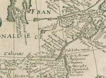
He explained, below the "Salt Villages", a mass of hostile Indians had, implied, arrived and some believe these to be "Shanwans" of Vielles Expedition of 1692~94, ancient Shawnee.
In 1669, John Lederer of Maryland for the Virginia Colony and the Tennessee Cherokee had visited the mouth of the Kanawha and reported no hostilities on the lower streams of the Alleghenies.
Some earlier scholars found evidence these Proto-historics were either Cistercians of Spanish Ajacan Occuquan outpost on the Potomac River or Jesuits and their Kahnawake Praying Indians (Mohawk) on the Riviere de la Ronceverte.
Sometime before 1712, the Canawest ("Kanawhans"-"Canallaway"-"Canaragay") had moved to the upper Potomac and made a Treaty with the newly established trading post of Fort Conolloway which would become a part of western Maryland during the 1740s.
Prior to European exploration and settlement, trails through the Alleghenies had been transited for many generations by American Indian tribes such as the Iroquois, Shawnee, Delaware, Catawba and others, for purposes of trade, hunting and, especially, warfare.
[17] Indian trader Charles Poke's trading post dates from 1731 with the Calicuas of Cherokee Falls still in the region from the previous century.
However, an example is the "Van Metre" trading house mentioned in an earlier edition of the "Wonderful West Virginia Magazine" being on the South Branches of the upper reaches of the Potomac.
The first permanent European settlers west of the Alleghenies have traditionally been considered to have been two New Englanders: Jacob Marlin and Stephen Sewell, who arrived in the Greenbrier Valley in 1749.
They built a cabin together at what would become Marlinton, West Virginia, but after disputing over religion, Sewell moved into a nearby hollowed-out sycamore tree.
In March 1742, a frontiersman named John Howard—along with his son and others—had been commissioned by Governor Gooch to explore the southwest of Virginia as far as the Mississippi River.
Howard's description of the South Branch Potomac River resulted in the definite decision by Fairfax to secure his lands in the region.
Permanent white settlement of the northern Alleghenies was facilitated by the explorations and stories of such noted Marylanders as the Indian fighter and trader Thomas Cresap (1702–90) and the backwoodsman and hunter Meshach Browning (1781–1859).
[24] The Braddock Road was superseded by the Cumberland Road—also called the National Road—one of the first major improved highways in the United States to be built by the federal government.
)[citation needed] The Chesapeake and Ohio Canal — also begun in 1828, but at Georgetown — was also a public work of enormous economic and social significance for the Alleghenies.
From the beginning, the B&O Railroad and the Chesapeake and Ohio Canal operated in bitter legal and commercial competition with one another as they vied for rights to the narrow strips of land along the Potomac.
It created a railroad and canal system across southern Pennsylvania between Philadelphia and Pittsburgh, intended to transport freight (notably including anthracite coal) and people with greater reliability, speed and capacity.
Lying astride the border separating the Union and Confederacy, the Alleghenies were among the areas most directly affected by the American Civil War (1861–1865).
The Battle of Rich Mountain (July 11, 1861) gave the Federals control of the turnpike, of Tygart's Valley, and of all of the territory of western Virginia to the north and west, including the railroad.
The very rugged terrain of the Alleghenies was not at all amenable to a large-scale maneuver war and so the actions that the area witnessed for the remainder of the conflict were generally guerrilla in nature.
This inequity created a bitter legacy that would last for generations and form the foundation of the mountaineers' poverty and the area's immense environmental degradation.
From the 1950s to 1992, the United States government maintained a top secret continuity program known as Project Greek Island at The Greenbrier hotel in the Alleghenies of southern West Virginia.