Arizona State Route 88
It runs from U.S. Route 60 (US 60) in Apache Junction through desert terrain to SR 188 near Roosevelt Dam.
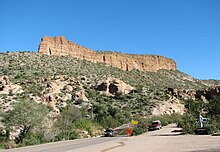
Following the Salt River for much of its length, the section east of Tortilla Flat is known as the Apache Trail and is part of the National Forest Scenic Byway system.
Following a junction with Old West Highway, SR 88 turns northeast onto Apache Trail and narrows to two lanes.
Passing a ghost town known as Goldfield, Apache Trail enters Tonto National Forest just northwest of Lost Dutchman State Park.
It passes through the town of Tortilla Flat, becoming an unpaved dirt trail winding eastward through the Superstition Mountains.
[3] The section east of Canyon Lake is part of the Apache Trail National Forest Scenic Byway system.
[7][8] Following the 2019 Woodbury Fire and subsequent damage to the unpaved portion of the route due to catastrophic flooding from the remnants of Hurricane Lorena, the road was closed from milepost 222 to 229 (Roughly midway from Tortilla Flat to Roosevelt Dam).