Arrowsic, Maine
During the French and Indian Wars, Arrowsic was site of a succession of important and embattled colonial settlements.
Abenaki Indians called the island Arrowseag, meaning "place of obstruction," a reference to Upper Hell Gate on the Sasanoa River.
[3] In 1649, John Richards purchased Arrowsic from the sachem Mowhotiwormet, commonly known as Chief Robinhood.
Clarke and Lake were Boston merchants, who built at Spring Cove on the island's northeast corner a stockaded trading post and blockhouse protected by at least two great guns.
In 1658–1659, land was cleared for pasturage, streets, a warehouse, sawmill, gristmill, bake house, blacksmith shop, cooperage and shipyard.
The village became the local court of law, headquarters of the general council, and place of protection for settlers in the region.
The evening before, an Indian woman appeared at the door of the Clarke and Lake fort seeking shelter.
As the warehouse was looted and village burned to ashes, a brave sported the captain's hat.
It was laid out with a common and, by order of the governor in 1688, a small, square palisaded fort on the ridge at the southern end of the island.
But King William's War broke out in May 1689, and by July, Newtown was destroyed and its garrison abandoned.
[6] Signed in 1713, the Treaty of Portsmouth brought a truce between the Eastern (Abenaki) Indians and English settlements.
Beginning on August 9, 1717, Massachusetts Governor Samuel Shute and Penhallow conducted a two-day conference on Arrowsic with delegates of various tribes, who arrived in a flotilla of canoes and encamped on Lee Island opposite the town.
[7] In the summer of 1723 during Dummer's War, Arrowsic was attacked by the Norridgewocks and their 250 Indian allies from Canada.
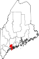
Separated by water, Arrowsic is near the towns of Woolwich to the north, Westport to the east, Georgetown to the southeast, Phippsburg to the southwest, and Bath to the northwest.