Aunis
Aunis is mostly a rolling chalk plain, whose navigable rivers have always been important modes of communication, and from which came economic development and the urbanisation of the region.
[Note 1] Aunis is a chalk plain of the Jurassic period, characterised by gently rolling hills, where no valley is completely enclosed, and where the land has a regular descent towards the sea.
The chalk table completes the triangular promontory which juts into the Atlantic, forming the northern extremity of the Aquitaine Basin.
The regional railways connecting Nantes to Bordeaux also serve Aunis, passing through La Rochelle, Châtelaillon-Plage and Rochefort.
The modernisation of communication infrastructure had its heyday in the second half of the 19th century, at the end of the Second French Empire, and economic activity diversified.
Aunis does not have the strong industrial tradition which is the trademark of regions of the North and of Lorraine, and it was only at the end of the 19th century that factories started to be developed.
In 2006 the population density of the Île de Ré was the highest of the entire French coast, being a record high of 207/km2 (540/sq mi).
Following the partition of Aquitaine into nine counties, as decreed by Charlemagne in 778, the name of Aunis, written as Latin: Pagus Alnensis, appeared in the last will and testament of Count Roger.
In Celtic and Gallo-Roman times, the northern part of Santonie,[Note 16] which became called "Aunis", was a long-neglected region far from civilisation, with no communications.
[12] For many centuries this huge forest made a near-impenetrable natural frontier stretching from the rivers Boutonne and Charente to the east,[13] which kept it apart from the ancient province of the Pictones.
[14] This was the pays des aulnes (English: Alder Region), where the trees had established themselves on riverbanks and in the marshy valleys, but where beeches and oaks also made up a dark and mysterious forest, awe-inspiring and full of superstition.
[16] Finally, the valleys of the rivers Curé, Virson, Mignon, and Gères, which were much larger than today, cut deeply through the region's invading forest.
But they had the inconvenience of being marshy and prone to floods that turned them into real marshes and bogs, making the region particularly difficult to reach.
[17] The coast was occupied by the Celts, even during the time of Pagus Santonum – they preferred to call the area Saintonge and themselves Santones – and then the Romans in the 1st century BC.
Saintonge offered better living and working conditions than the northern area (Aunis) thanks to the large valleys of the river Charente and its two principal tributaries, the Seugne and the Boutonne.
The huge Gironde Estuary of the Seudre allowed direct contact with the more advanced civilisation of the Roman Empire to the south, via the Garonne valley.
[Note 18] The Santones had worked laboriously to perfect a technique of saltwater extraction, and their ancient production sites were put right on the shoreline.
[Note 19] These small-scale production sites were particularly numerous in the north of the Gulf of Santones, equally along the coastline, in the deep estuaries, and all around the islands (notably the Île d'Albe).
Salt production, which before had been driven by profit, could be done faster around the Gironde,[Note 21] which became an important arterial river for the transport of goods to and from the southern provinces of the Roman Empire.
During the first three centuries of the Gallo-Roman period, the Romans were especially keen to colonise the area between the coastline of Aunis and the ancient sylve d'Argenson ("Forest of Argenson"), taking lands latterly in Santone hands.
The new colonists, somewhat turning their backs to the sea, set up their villae – large farms of some dozens of acres, predating the towns themselves – at Ardillières, Le Thou, Ballon, and Thairé.
During the 1st century AD they had built the Roman road connecting Mediolanum Santonum (Saintes) to Juliomagus (Angers) but it passed Aunis by, so clearings were opened into this vast forest, notably at Vouhé.
[24] In the 4th century AD the Romans decided to clear the Forest of Argenson along the southern shores of the Gulf of Pictones, which had been occupied by Celts since ancient times.
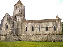
So in the 9th century the Duke of Poitou built the fortified city of Surgères,[33] also called the castrum of Benon, with "a tower that stood in the middle of a square, encircled by two paths and three moats".
The clearings opened the way into the ancient forest to set up villages and farming (wheat, oats, barley) and to plant vines.
[41] With the official establishment of the province in 1374, during the reign of Charles V of France, Aunis recovered Rochefort and Marennes, but its eastern boundaries were still vague.
[42] The Protestant Reformation, started in the time of Francis I of France, gave Aunis much greater power: it was the last stand of the resistance movement, which survived until La Rochelle fell in 1628.
Despite the resistance of its inhabitants and the energetic interventions of its leaders, in 1790 it was coalesced with the much larger region of Saintonge to form the Department of Charente-Maritime.
[Note 24] L'aultre partie, cependent, tirera vers Onys, Sanctonge, Angomoys et Gascoigne, ensemble Perigot, Medoc et Elanes.
Sans resistence prendront villes, chasteaux et forteresses.The other party, meanwhile, will head for Aunis, Saintonge, Angoumois and Gascony, together with Périgord, Médoc and Elanes.