Ballysadare
Ballysadare (Irish: Baile Easa Dara, meaning 'town of the waterfall of the oak'),[2][3] locally also Ballisodare,[4] is a town in County Sligo, Ireland.
There appear to be three variants of English version of the settlement name still in use, Ballysadare being on the road signs coming to dominate.
The use of Ballisodare remains in evidence on the names of some local sport clubs and even on at least one Sligo County Council document in 2018.
[5][6] Ballysodare appears to been used for the railway station and there is evidence of its use on a map of 1887 and indexing of parish registers at the National Library of Ireland.
[7][8] Ballysadare is a possible location for the town noted as Nagnata on Claudius Ptolemy's 2nd century CE co-ordinate map of the world.
St. Columba visited Ballysadare in 575 AD at which "Before the Saint (Columba) returned to Britain he founded one church in the district of Carbury, and proceeded from thence to a place called Easdara, where all the prelates of the neighbouring regions, and vast numbers of holy men and women had come to meet him ; and, to say nothing of the rest of the multitude, which was almost beyond counting, a great many distinguished saints of the race of Cumne are recorded to have been present."
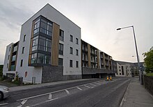
The area experienced rapid development during the 'Celtic Tiger' boom, with the population almost trebling in the period between the 1996 and 2022 census (from 612 to 1,747 people).
It is home to St. Mary's College,a secondary school which serves the southern and western environs of County Sligo, including the surrounding areas of Collooney and Coolaney.