Barmah National Park
[2] The park is located adjacent to the Murray River near the town of Barmah, approximately 225 kilometres (140 mi) north of Melbourne.
[10][11] Hardwood timber was harvested from the Barmah region from around 1870,[11] and logging of river red gum and seasonal cattle grazing were important local industries until recently, ceasing when the national park was created.
[12][13] The Barmah muster yards, located in the southern end of the park, and used for management of cattle grazed in the surrounding river red gum forests, were heritage listed in 2009.
[13] In July 2010, the Government of New South Wales declared the Millewa Forest, on the northern banks of the Murray River, as a national park.
[19] Since clearing for agriculture and the subsequent dam construction took place, the Murray River has undergone extensive flow regulation.
[19][23] The increased incidents of smaller summer and autumn floods, which affect low-lying areas of Barmah National Park, are sometimes caused by heavy rains.
[19] More often, they occur because there is sufficient rainfall for irrigated farmland between the Hume Dam and the Barmah Forest, consequently river diverters do not choose to take allocated water, Lake Mulwala (Yarrawonga Weir) also has inadequate storage,[19] resulting in high level river flows referred to as "rainfall rejections".
[34] A number of marsupial species are also no longer found within the park, including the rufous bettong, bridled nailtail wallaby, western barred bandicoot, and lesser stick-nest rat.
[10] Though the future impact of climate change on river red gum forests is unknown, there has already been a significant dieback of trees in the area due to ongoing evapotranspiration deficits.
[35] In the Murray-Darling Basin, prior to regulation of the Murray River, extensive Moira grass (Pseudoraphis spinescens) dominated floodplain marshes existed in areas that were typically seasonally flooded for 5–9 months duration in most years, to a minimum water depth of 0.5 m, and completely dry during late summer and autumn.
[36][37] Floodplain areas previously dominated by aquatic species, such as Moira grass, common reed (Phragmites australis), and cumbungi (Typha spp.
), are now covered with species adapted to lower levels of flooding, mainly river red gums and giant rush (Juncus ingens).
[40] Reductions in duration and depth of natural flooding due to regulation of the Murray River, grazing and trampling pressure by introduced animals, particularly by feral horses (and previously cattle), and invasive plant species are the main causes of this decline.
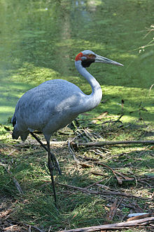
[44] Parks Victoria's plan to reverse environmental degradation and definitively improve management of Barmah National Park prioritises timing of seasonal flooding to promote the growth of floodplain vegetation and provides habitat for breeding waterbirds, control of invasive plants, and the eradication of introduced grazing animals including horses, deer, pigs and goats.
The aims of management plans are to protect the floodplain marshes, including increasing the extent of Moira grass plains, and to improve the quality of habitat for native flora and fauna in the Barmah National Park.