Basra vilayet
It historically covered an area stretching from Nasiriyah and Amarah in the north to Kuwait in the south.
[3] At the beginning of the 20th century it reportedly had an area of 16,482 square miles (42,690 km2), while the preliminary results of the first Ottoman census of 1885 (published in 1908) gave the population as 200,000.
[2] The accuracy of the population figures ranges from "approximate" to "merely conjectural" depending on the region from which they were gathered.
[2] The capital of the vilayet, Basra, was an important military centre, with a permanent garrison of 400 to 500 men, and was home to the Ottoman Navy in the Persian Gulf.
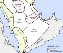
This would last until World War I. Basra fell to the British on 22 November 1914, and the Mesopotamian Expeditionary Force had occupied almost the whole of the vilayet by July 1915.