Bathurst, New Brunswick
The so-called Red Pine solid waste facility provided by the Chaleur Regional Service Commission serves, in addition to Bathurst, municipalities all over north-eastern New Brunswick.
[44] Jean Jacques Enaud, who hailed from the French Basque Country, was granted in 1638 the seignory at the southeastern gap of the harbor later named Alston Point.
[45][46] Remark is made on William Francis Ganong's map of Bathurst Harbour, depicted here at left, of the residence of Nicolas Denys and the seignory of Gobin.
Little is known about the region between the death of Nicholas Denys in 1688 and the Treaty of Utrecht (1713), whereby Louis XIV ceded the territory of Acadia to Anne, Queen of Great Britain.
[48] Historians remark the Battle of the Restigouche in June 1760 (one of the final events in the Seven Years' War) in the Baie des Chaleurs, and various other incidents as the colony of Nouvelle France expired.
[49] According to Gamaliel Smethurst, a trader who supposedly was permitted there by Governor Murray, the British attempted to remove the remaining scattered Acadians from the Nepisiguit basin and Caraquet in late October 1761.
[54] It seems that the great 1825 Miramichi Fire had a significant impact on the fortunes of Bathurst, for the devastation of 6,000 acres[55] forced northwards many displaced people.
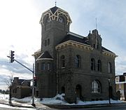
A man named Cooney wrote in May 1832 that in 1828, Bathurst only contained a few houses, but that four years' hence it had sprouted a brick courthouse roofed with slate, a gaol, a post office, a few mercantile establishments, and more than 30 homes.
What we now know as Riverside Drive was populated by several Francophone families (who are assumed to be the remnants of Captain MacKenzie's evacuation) and their "neat little Chapel... and two or three rustic windmills", presumably for grinding grain.
[58] Joseph Cunard, attracted by the county's timber resources, set up a branch of his family's shipbuilding firm here[59] at some time after the great fire in Miramichi of 1825.
[60] By 1828, he was elected to the Legislative Assembly of New Brunswick as representative for Northumberland County, and was variously a justice of the peace and served on the board of health.
For this sum, the employers would be transported with their bags to the salmon pools, would have their meals cooked for them, flies tied for them, rods repaired for them, and clothes washed for them.
Residents of a harbour that in addition thrived as a shipbuilding center could see little advantage in tying themselves to the anchor that was at the time the United Provinces of Canada.
[75] In the 19th century, men were eager to fell trees in the forest around Bathurst all winter long from sunup to sundown (Sundays excepted) for eight to ten dollars a month.
Navigation in this County consisted of the carrying of wood, fish and grindstones from Bathurst to Britain, ports of the Dominion, Newfoundland, Miquelon, the United States, South America and Italy.
[84] The opening of the Intercolonial Railway of Canada in 1876 (shown at the left hand side in the Ganong map) provided a fast connection from the port of Bathurst to the rest of North America which was essential for developing the region's principal industries in forestry and zinc mining.
For example, the St. Lawrence Lumber Co., which is depicted in the Ganong map at the mouth of the Nepisiguit River, was managed in the late 19th century by Kennedy Francis Burns of Miramichi.
[87] That year, John P. Leger formed a private venture called the Bathurst Electric and Water Power Company, with aim to erect and operate at Tetagouche River Falls a hydro-electric plant.
The province empowered it in 1904 to lay track between Nepisiguit Junction and Grand Falls, a distance of 16 miles, to serve the short-lived Drummond Iron Mines.
[90] The Annie R. plied her trade between Bathurst, Carron Point and Youghall Beach early in the 20th century (before private motorized transport became the norm) under the command of Jack Stever.
[92] Bathurst was incorporated as a town in 1912,[80][93] following a poll of ratepayers and property holders conducted on 30 May that year in which a majority vote of 195 to 54 determined the outcome.
In 1921 the College Sacre-Coeur, a Roman Catholic residential high school for Acadians, was relocated to Bathurst from its previous home in Caraquet.
It was entrusted by deed to the Religious Hospitallers of St. Joseph, and located at Vallee Lourdes just north of the town on a 1,000 acre farm which today houses the Chaleur Regional Hospital.
[75] On 27 September 1943, German spy Wolfgang Heyda, who had been interned in Bowmanville, Ontario, evaded capture in Montreal and Bathurst, but finally was caught in Grande-Anse.
[107] The same year saw the installation of an artificial ice surface at the hockey barn near the paper mill:[108] a levy was voted for this purpose at the special meeting of Town Council on 11 September, which followed a plebiscite on the issue.
[112] Sacred Heart University awarded "local boy made good" Sir James Dunn an honorary Social Science doctorate in May 1954.
[113] The institution had been granted the power to confer degrees by a 1940 Act of Parliament, which lasted until in 1974 the Board of Directors transferred control to the provincial government of Richard Bennett Hatfield, and it became known as the Bathurst Community College.
[120] Construction of the present airport near South Tetagouche was begun in 1964 as a project funded by the Town of Bathurst and Gloucester county municipalities.
The Downtown Bathurst Revitalization Corporation and the local chapter of the Canadian Red Cross were active in the efforts to support the afflicted.
[151] On December 17, 2010, it was determined that an environmental assessment was required in relation to an expansion of a sawmill project because the Atlantic Canada Opportunities Agency considered providing financial assistance to the proponent.