Battle of La Malmaison
After the four-day bombardment was extended by two more days because of bad weather, the French XIV, XXI and XI corps of the Sixth Army, attacked on a 12.1 km (7.5 mi) front with six divisions.
Nivelle claimed that a massive barrage on German lines could bring French victory in 48 hours and avoid the costly battles of attrition, grignotage (nibbling) fought in 1916.
[8] In the Second Battle of the Aisne (16 April – 9 May), the French failed to achieve their strategic objective of a breakthrough and a return to a war of movement but captured tactically important ground and inflicted many casualties on the German defenders.
The batteries of the neighbouring sectors also took part in the duel.and during 18 October, French detachments patrolled between Vauxaillon and Braye-en-Laonnois, destroyed several strong points and returned with 100 prisoners from four German divisions.
South of Fort de la Malmaison, in the centre of the plateau closer to the French lines, lay the huge Bohery Quarry, where the ground began to slope steeply down towards the Aisne valley.
The Montparnasse, Fort de la Malmaison and Bohery excavations, the Fruty Quarry on the edge of the Soissons–Laon road, about 1.6 km (1 mi) east of Laffaux Mill and many other subterranean obstacles faced the Sixth Army.
Before the Nivelle Offensive in April, d'Esperey had studied the tactical problems connected with the natural barrier between the Aisne and the plain at Laon and advised Maistre about the topography of the region.
French tanks (artillerie d'assault) had been technically improved since 16 April, when they had operated on the plain from Craonne to Berry-au-Bac, despite the steep spurs, cratered ground and the establishment of anti-tank batteries by the Germans.
The accuracy French gunnery was exemplary and on 21 October, an observer reported that under direction by an artillery-observation aeroplane, one of the 380 mm (15 in) guns fired five shells consecutively into the same hole.
The roof of the Montparnasse Quarry was made to resemble a honeycomb and despite its extraordinary thickness, at least two 410 mm (16 in) shells penetrated to the double gallery underneath, causing many casualties to the garrison.
Much of the German artillery was south of the canal, from Pinon to Pargny and was cramped for space in patches of woodland, so far back that only long-range fire could reach beyond the French front line.
Due to a lack of manpower, constant French artillery-fire and the autumn rains, the condition of the German defences was poor and in some places, only narrow trenches and shell-hole positions existed.
The plateau was separated from the Filain and Pargny-Filain area, on the east of the French attack front, by a valley into which the eastern or Bois de la Garenne gully opened, just south of Chavignon.
On the German right flank north of Moisy Farm entrenchments, round Mont des Singes to the bank of the Ailette, prevented an attacker from outflanking the heights in that direction.
[28] On 23 October at 5:45 a.m., the French infantry were to advance between the Anizy–Vauxaillon railway and Royère on a 10 km (6.2 mi) front, to the northern edge of the ridge on which lay the villages of Pinon, Chavignon, Pargny and Filain, in three stages.
[33] The German artillery reply began with a substantial counter-bombardment but this rapidly diminished, especially south of the Ailette, where the supply of ammunition and equipment was blocked by the thick gas cloud in the valley.
Round the Château de la Motte and to the north, at the strong point of Vallée Guerbette, below the east end of the Mont des Singes plateau, there was also a determined defence.
[39] The 38th Division ejected the Germans from Lady Trench, halted on the summit of the plateau, in front of Bois de Garenne, north of Chavignon and east of the Montparnasse Quarry.
From Bois de la Veau on the right, massed machine-gun fire was encountered but the surviving Zouaves, reached the remains of the counterscarp and entered the ruins of the fort.
The salient protruded north from the Chemin-des-Dames towards the valley of the upper Ailette, which made the remaining German positions on the crest and the northern slopes of the ridge further east untenable.
[e] Sporadic felling of fruit trees and demolitions either side of the Ailette, which had been seen by French airmen before the battle, became frequent and a pall of black smoke from fires, drifted over the plain.
By the evening, the German line ran from the plateau east of Vauxaillon, along the Pinonriegel north of Vaudesson and Chavignon, to the high ground of the ridge south-west of Pargny and then connected to the old position.
[52] On 25 October, the French attacked again and the German troops made a fighting withdrawal to the Ailette and the canal, which had been occupied by the 6th Bavarian Reserve and 6th divisions but few guns could be withdrawn.
The French guns enfiladed the Ailette valley to the east of the Bassin d'alimentation reservoir, bombarded the German defences on the north slopes of the Chemin-des-Dames ridge and the last strong points holding out on the summit with high-explosive, gas and shrapnel shell.
To avoid alerting the French, no demolitions of shelters, tunnels and pillboxes were made and a screen of machine-gunners and riflemen was left on the summit of the ridge to fire until just before dawn.
[57] The offensive had been intended to capture high ground from the Mont des Singes to the Californie Plateau above Craonne and be economical in infantry, rather than break through the German fortified zone.
Pétain issued a communiqué on the evening of 23 October, announcing that the Sixth Army had taken more than 7,500 prisoners and an enormous quantity of equipment, including 25 heavy and field guns.
On 24 October, a German communiqué announced that Allemant, Vaudesson and Chavignon had been lost but claimed victory west of La Royère Farm, where no attack had taken place.
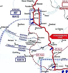
[61] The French success at La Malmaison prevented Hindenburg and Ludendorff from further reinforcing the Austro-Hungarians in Italy and assisted the surprise gained by the British at the Battle of Cambrai (20 November – 7 December).
The extension of the northern face of the salient from Vauxaillon to Craonne and Berry-au-Bac, beyond the Chemin-des-Dames ridge to the left bank of the Ailette during the Battle of Malmaison, caused Ludendorff to hold back Heeresgruppe Deutscher Kronprinz (Army Group German Crown Prince), until Allied reserves had been shifted west and north of Soissons.