Bedford, Western Australia
Bedford is a suburb 6 kilometres (4 mi) north-east of the central business district (CBD) of Perth, the capital of Western Australia.
Named after Frederick Bedford, the Governor of Western Australia from 1903 to 1909, the suburb is within the City of Bayswater local government area.
It is predominantly a low density residential suburb consisting of single-family detached homes, with clusters of commercial buildings along Beaufort Street, Grand Promenade and Walter Road.
The first major developments for the suburb occurred in the 1920s, when the extension of Beaufort Street and its associated tram service into the area triggered housing construction.
Bedford Park was gazetted as a townsite in 1937, and major growth occurred following World War II, due to developments by the State Housing Commission.
The survey resulted in the land being divided into long, narrow rectangular strips extending from the river.
The colonists were disappointed to discover that most of the area inland was unsuitable for European agriculture, being sand dunes interspersed with swampland.
Most of these colonists either died or left the area soon after, and none of them settled in the present day Bedford, far away from the Swan River.
This generated the first major development in Bedford Park, which was at the time just an extension of Inglewood into the Bayswater Road District.
[6][2] It consisted of 53 hectares (130 acres) of land centred on the intersection of Beaufort Street and Grand Promenade.
[2] During World War II, the tram was extended to Grand Promenade, as one of the final extensions to Perth's tramway system.
By switching the entrances from one side of the house to the other, or by placing them in the middle, by running gables at different angles and by general architectural modifications, complete dissimilarity has been achieved.
[5]: 234–235 The expanding population of Bedford Park and its neighbouring suburb of Bayswater necessitated a new primary school in the late 1940s.
[5]: 221 Starting in 1948, Perth's tramways began to gradually shut down, due to the increasing use of private cars crowding roads and reducing patronage.
[10] By the early 1970s, major development of Bedford was complete, the last road being Gummery Street in the suburb's north.
[11] In September 2018, 24 year-old Anthony Robert Harvey was arrested for the murder of his family of five in a house on Coode Street.
[3] It is surrounded by Morley to the north-east, Dianella to the north-west, Inglewood to the south-west, Bayswater to the south-east, and Embleton to the east.
[21] Bedford is zoned as "urban" in the Metropolitan Region Scheme,[22] and consists predominantly of single-family detached homes, with clusters of commercial buildings along Beaufort Street, Grand Promenade and Walter Road.
The dunes form low-lying hills made of heavily leached white to grey sands, which are poor at retaining nutrients.
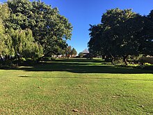
[36] The portion of Bedford used as public open space is less than the 10% recommended by the state government's liveable neighbourhoods policy.
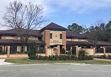
Expansions occurred in the 1950s, and in 1957, a secondary school for girls named St Thomas Aquinas College opened on the same site.
[38] Meanwhile, St Mark’s College, a secondary school for boys, was established on Beaufort Street in Bedford.
Bedford is within the electoral district of Maylands,[45] which is a strong seat for the centre-left Labor Party, who have held it since 1968.
In the Western Australian Legislative Council, this district is part of the East Metropolitan electoral region.
All these roads aside from Coode Street have two lanes in each direction and a speed limit of 60 kilometres per hour (37 mph).
Grand Promenade links to Dianella Plaza and Morley Drive in the north-west, and Garratt Road in the south-east.
[21] Along Beaufort Street, Bedford is served by Transperth routes 66 and 950, both of which travel between Galleria bus station and the Perth central business district.
Routes 998 and 999, also known as the CircleRoute, travel along Coode Street and Walter Road, deviating off to Galleria bus station.
Route 67 travels along Grand Promenade towards Mirrabooka bus station and along Beaufort Street to Perth Busport.
Route 68 takes a similar path, but deviates along Craven Street and various other minor roads in Bedford.