Beeston Regis
On Beeston Regis Heath there are circular pits called 'Hills and Holes' (from the first edition of the Ordnance Survey map of the area).
The west wall is standing almost intact to gable height, although the lining of the original door has been replaced by modern brickwork.
The common was made a Site of Special Scientific Interest/SA6 in the year 2000 and is habitat for a wide range of mammals, birds, and insects.
Twenty-six species have been regularly recorded, including green hairstreak, brown argus and Essex skipper.
Foxes and muntjac deer along with smaller mammals such as water shrew, field voles, and harvest mice are present.
The Back Common, although not as species-rich as the Site of Special Scientific Interest is home to a great many plants and insects.
Along the edges of Beeston Beck and Sheringham Loke, monkey musk grows in abundance and until a few years ago dittander, a rare plant, was present, although this may have since been lost due to the mowing regime.
This is originally one of a pair which stood at either side of a pathway in the yard of the farmhouse, in the grounds of the ruined Beeston Priory.
A local tale says that about 1938–41, when both boulders were in place, a farmer named James Reynolds often drove his horse and cart along this pathway.
Several times, a hooded grey ghost would hide behind two boulders and would leap out from behind one of the stones at sunset, and try to grab the horse's reins before vanishing.
James Reynolds died in 1941 and, in accordance with his wishes, the boulder now lies atop his grave, his wife Ann Elizabeth also being interred there in 1967.
Orben Beck [13] is a tiny pond of half an acre located in a cliff-top caravan park and only yards from the sea.
[14] Abbey Farmhouse is a Grade II listed building[15] and is located on the Eastern side of Beeston Regis Common.
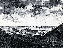
[17] The two hills were left behind when glaciers retreated northwards at the end of the last Ice age, between 15,000 and 10,000 years ago,[17] a recent event in geological timescales.
At that time most of what is now the North Sea was dry land, with the Rhine and the Thames combining to form a giant river estuary.
In recent times, coastal erosion has been slowed by building groynes and sea walls along the coast and below the hill.
During low tides on the foreshore of the sandy beach beneath Beeston Hill, one can find the curious paramoudras and flint circles.
Local folklore tells of the southern slopes of the Bump being festooned with grapevines, tended by the monks of the priory.
Each Easter, the combined churches in the area make a pilgrimage carrying a cross to the top of Beeston Bump, and an open-air service takes place.
During the World War II Beeston Bump was the location for one of the network of Signals Intelligence collection sites: Y-stations.
These stations collected material to be passed to the War Office's Government Code & Cypher School at Bletchley Park.
On the southern edge of the octagon is a raised area of concrete, which is 225 mm (9 inches) higher than the rest of the base.
It would have consisted of a double-skinned wooden structure in which the cavity was filled with shingle designed to make them "splinter proof" or "bulletproof".
There is a legend in East Anglia about a ghostly black hound from hell that roams the coast and lonely lanes of Norfolk.
[19] The hound is the size of a small horse and appears from the depths of Beeston Bump with malevolent flaming red eyes.
The legend was the inspiration behind Sir Arthur Conan Doyle's[20] Sherlock Holmes story, The Hound of the Baskervilles.
[citation needed] Beeston Regis' War Memorial takes the form of two plaques located inside All Saints' Church.