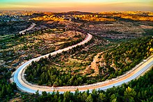
Beit Surik
Fragments of Corinthian columns have been found, and a mosaic floor, with dedicatory inscription in Greek and tabula ansata was excavated in part by LH Vincent in 1901.
[12][13] In 1738 Richard Pococke noted the village, Bethsurick, as he passed between Biddu (Bedou) and Beit Surik.
[14] In 1838 Beit Surik was noted as a Muslim village, located in the Beni Malik district, west of Jerusalem.
[15][16] In 1863, the French explorer Victor Guérin noticed there a "beautiful piece of antique wall", with several layers, formed of large stones.
[18][19] In 1883, the PEF's Survey of Western Palestine described Beit Surik as a "small stone village on a hill-top.
A group consisting of armoured cars, a Davidka, reserves and the operation's HQ approached from Jerusalem.
The company approaching from Castel encountered a group of around 30 armed men leaving Beit Surik heading east but did not engage them.
Three platoons went through the village clearing enemy positions while a detachment of sappers began demolishing buildings.
[38] After the 1995 accords, 10.3% of the village land was classified as Area B, while the remaining 89.7% was classified as Area C.[39] On the morning of 26 September 2017, a Palestinian gunman from Beit Surik opened fire, shot Israeli security guards at a checkpoint in Har Adar, killing three and wounding one.
From "The Beit Sourik Case (HCJ 2056/04)" of 30 June 2004 the standards of proportionality between Israeli security and the injury to the Palestinian residents was set by the judgement of the Supreme Court of Israel.
The International Court held that Israel is under an obligation to discontinue building the Wall and to dismantle it forthwith.
Repeated attempts by villagers to construct a dome were met with unexplained failure; structures erected were found dismantled by the following day, resulting in a site consistently left in disrepair.
This series of events eventually led to the abandonment of the dome project, in a collective decision that respected what was perceived as the saint's wishes.