Bhima River
It flows southeast for 861 kilometres (535 mi) through Maharashtra, Karnataka, and Telangana states, before joining the Krishna River.
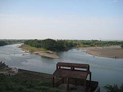
After the first sixty-five kilometers in a narrow valley through rugged terrain,[1] the banks open up and form a fertile agricultural area which is densely populated.
[clarification needed] In 2005, it caused severe flooding in Solapur, Vijayapura and Kalburgi districts.
[7] From there it is 8 km along the river to the railroad bridge at the town of Rajgurunagar (Khed) on the left bank.
After the Indrayani, about 4 km downstream, the Dhomal River enters from the right,[13] at the village of Wadhu Budruk.
Bhima merges into the Krishna along the border between Karnataka and Telangana about 24 km north of Raichur.
Total Water storage capacity of Bhima basin is about 300 TMC in Maharashtra state.
Bhima to Sina interlink (Jod Kalava) with 21 km tunnel from Ujjani reservoir is constructed to supply water for vast lands in catchment area of Sina tributary from main Bhima river.
The diverted water is nearly 42.5 TMC which is mostly going waste to Arabian sea after generating hydro power.
[24] However, Bhira hydro station can be operated in pumped storage mode to generate peaking power without releasing water to Arabian sea.