Bird City, Kansas
[6] Bird City was a station and shipping point on the Chicago, Burlington and Quincy Railroad.
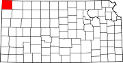
[7] According to the United States Census Bureau, the city has a total area of 2.23 square miles (5.78 km2), all land.
[9] The 2020 United States census counted 437 people, 205 households, and 112 families in Bird City.
There were 271 housing units at an average density of 119.6 per square mile (46.2/km2).
40.5% of households consisted of individuals and 22.9% had someone living alone who was 65 years of age or older.
[19][20] As of the census[21] of 2010, there were 447 people, 211 households, and 118 families residing in the city.
There were 264 housing units at an average density of 118.4 per square mile (45.7/km2).
40.8% of all households were made up of individuals, and 24.6% had someone living alone who was 65 years of age or older.
As of the census[22] of 2000, there were 482 people, 232 households, and 128 families residing in the city.
43.1% of all households were made up of individuals, and 28.4% had someone living alone who was 65 years of age or older.
The community is served by Cheylin USD 103 public school district.