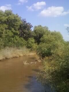
Black Kettle National Grassland
The terrain is characterized by sandy and red slate hills in addition to grassland and oak brush.
[3] This Black Kettle National Grassland was home to the Comanche and other nomadic Indian tribes who camped and hunted in the area, attracted by abundant water and wood and buffalo herds.
In 1868 Lt. Col. George Armstrong Custer led an attack on a Cheyenne village here in what was called the Battle of the Washita.
The area became part of the Cheyenne and Arapaho Indian reservation in 1867, but the treaty lands were partitioned and shrunk by multiple federal acts, including the Dawes Act which carved the land into parcels owned by individual households, and was opened to private settlement in 1892.
"Poor conservation and agricultural practices, combined with periods of wind, drought, and rain stripped the area of its topsoil" and the government bought the land from bankrupt farmers.
In 1938, the Soil Conservation Service began a replanting and restoration effort and in 1960 it was designated a national grassland.
Spring Creek Lake is 14 miles (23 km) north of Cheyenne and is 50 acres (20 ha) in size.