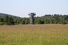
Black Moor (Rhön)
It is part of the Europe-wide conservation system, Natura 2000, and one of the most important raised bogs in Central Europe.
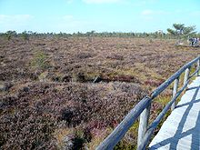
From its central plateau which lies near the higher edge of the bog in the north, where the peat is up to 8 metres thick in places, the surface of the terrain falls away on all sides.
On the steepest slopes there are hollows running parallel to the contours: elongated, sharply defined troughs known as flarks (Schlenken).
This stream empties into the Streu, six kilometres east and 400 metres lower down, its waters forming part of the drainage basin of the River Rhine.
Another stream drains the bog into the Hessian Ulster, which is three kilometres to the west and just under 300 metres lower and belongs to the Weser basin.