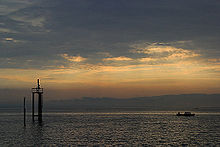
Lake Constance
The High Rhine flows westbound out of the lake and forms (with the exception of the Canton of Schaffhausen, Rafzerfeld and Basel-Stadt) the German-Swiss border as far as to the city of Basel.
The culminating point of the lake's drainage basin is the Swiss peak Piz Russein of the Tödi massif of the Glarus Alps at 3,613 metres (11,854 ft) above sea level.
The downward erosion of the High Rhine caused the lake level to gradually sink and a sill, the Konstanzer Schwelle, to emerge.
Around 75 AD, the naturalist Pliny the Elder called them both Lacus Raetiae Brigantinus after the main Roman town on the lake, Brigantium (later Bregenz).
The German name of the lake, Bodensee, has been adopted by many other languages, for example: Dutch: Bodenmeer, Danish: Bodensøen, Norwegian: Bodensjøen, Swedish: Bodensjön, Finnish: Bodenjärvi, Russian: Боденское озеро, Polish: Jezioro Bodeńskie, Czech: Bodamské jezero, Slovak: Bodamské jazero, Hungarian: Bodeni-tó, Serbo-Croatian: Bodensko jezero, Albanian: Liqeni i Bodenit.
However, this assumption was based on an error (similar to that of the Teutoburg Forest and the Taunus): the Romans sometimes used the name Mare Suebicum for the Baltic Sea, not Lake Constance.
The authors of the Early Modern Period overlooked this and adopted the name for the largest lake in the middle of the former Duchy of Swabia, which also included parts of today's Switzerland.
The earliest Neolithic farmers, who belonged to the Linear Pottery culture, also left no traces behind, because the Alpine foreland lay away from the routes along which they had spread during the 6th millennium BC.
In 2015, a 20 km line of about 170 man-made under-water stone mounds [de] dated in the neolithic period or early Bronze Age was discovered on the south-west shore of the lake between Bottighofen and Romanshorn.
The settlement of the shore of Lake Constance during the Hallstatt period is attested by grave mounds, which today are usually found in forests where they have been protected from the destruction by agriculture.
During the La Tène period from 450 BC, the population density decreases, as can be deduced partly due from the fact that no more grave mounds were built.
After the borders of the Roman Empire were drawn back to the Rhine boundary in the 3rd century BC, the Alemanni gradually settled on the north shore of Lake Constance and, later, on the south bank as well.
The Untersee, or Lower Lake, which is separated from the Obersee and from its north-west arm, the Überlinger See, by the large peninsula of Bodanrück, has an area of 63 km2 (24 sq mi).
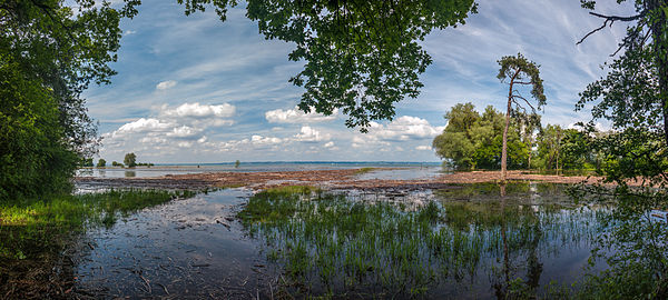
Because the Alpine Rhine brings with it drift from the mountains and deposits this material as sediment, the Bay of Bregenz will silt up in a few centuries time.
According to the data of the International Water Protection Commission for the Lake Constance, the approximate shore length is 273 km (170 mi) (see Coastline paradox).
Several smaller harbors on the Upper Lake offer boat trips along the German or Swiss coast (with one continuing over the Old Rhine to Rheineck).
The harbour in Konstanz is also served by the Schweizerische Schifffahrtsgesellschaft Untersee und Rhein (URh), which operates via the Seerhein, Lower Lake and High Rhine to Schaffhausen.
[30] It docks at the harbours of Kreuzlingen, Konstanz, Gottlieben, Ermatingen, Reichenau, Mannenbach, Berlingen, Gaienhofen, Steckborn, Hemmenhofen, Wangen, Mammern, Öhningen, Stein am Rhein, Diessenhofen, Büsingen and Schaffhausen.
The lines are operated by regional train services (S-Bahn, RegioExpress, Regional-Express) spreading over four countries (Austria, Germany, Liechtenstein, Switzerland).
Long-distance trains (RJ/RJX, EC/ECE, IC (DB)/IC (SBB), IR, IRE) link larger lakeside railway stations (e.g., Bregenz, Friedrichshafen Stadt, Konstanz, Lindau-Reutin, Romanshorn) with major cities.
[33] The climate of the Lake Constance area is characterised by mild temperatures with moderate gradients, thanks to the balancing and retarding effect of the large body of water.
Autumn is generally the time when Lake Constance starts to experience more foggy mornings again, but the day temperatures still range between 21 in the beginning and 10-12°C at the end of the season.
Lake Constance is one of the best known wine growing regions in Germany and experiences several outdoor events during harvest time in autumn.
It can happen that, due to the differently regulated responsibilities and assessments, a gale warning is issued on the Swiss side of the Obersee, but not on the German or Austrian shores, and vice versa.
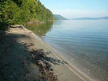
[40] One unique species among the local flora is the Lake Constance forget-me-not (Myosotis rehsteineri), whose habitat is restricted to undisturbed limestone gravel beaches.
The opossum shrimp, which occurs in many places in shoals of several million in winter, are already an influential link in the food chain in Lake Constance.
Important are especially towns like Konstanz, Überlingen, Meersburg, Friedrichshafen, Lindau, Romanshorn, Rorschach and Bregenz as they are the big hubs for boating tourism and lake crossing ferries.
The Hegau region adjacent to Lower Lake Constance (Untersee) contains several higher mountains of volcanic origin, many with ruins of fortresses on their tops (e.g. Hohenkrähen, Mägdeberg).
Diving at some spots like the devils table ("Teufelstisch") called rock needle in the lake in front of the Marienschlucht, is only allowed after approval by the district office Konstanz.
A famous freshwater wreck in Europe is the paddle steamer Jura, which lies in front of Bottighofen at a depth of 39 metres (128 feet).