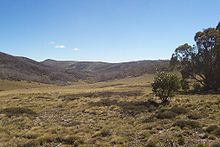
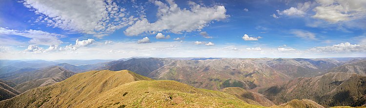
Bogong High Plains
A trail called Australian Alps Walking Track is popular for hiking in summer and cross-country skiing in winter.
[3] Local towns and villages provide the best possibility for exploring the areas, including Mount Beauty and Harrietville.
The traditional custodians of the land surrounding the Bogong High Plains are the indigenous Australian Bidawal, Dhudhuroa, Gunai–Kurnai and Nindi–Ngudjam Ngarigu Monero peoples.
These original plots have been monitored ever since, and represent the longest continuous series of ecological data of any site in Australia.
[6] All grazing was finally excluded from the area by the Victorian government in 2005, in part because of the compelling evidence provided by this particular experiment.
[citation needed] The Bogong High Plains continues to have an important place in scientific research.
In summer, large numbers of scientists conduct research in the area, including studies of hydrology, vegetation change, fire response, weed invasions, occurrence of native animals (mountain pygmy possum, alpine skink) and introduced species (such as hares, horses and sambar deer).
The area is also home to a component of the International Tundra Experiment (ITEX), which investigates aspects of global climate change.
More recently the area was again threatened during the 2006-07 Australian bushfire season but due to favourable weather, damage appears to be minimal in comparison.
Alpine huts in the area provide accommodation for people out in the winter ski touring and those interested in hiking or other activities in the summertime.
It has the best facilities[citation needed] of any hut or lodge outside of a resort in Australia, with full comforts and amenities for 35 people.
Approximately 25% of the High Plains are grasslands, which occur in more exposed areas, on gentle slopes are typically more resistant to wind and frosts.
The Bogong High Plains Road runs from Mt Beauty, up to the ski resort of Falls Creek, up to an elevation of around 1720m, before steeply descending through Trapyard Gap at gradients frequently exceeding 9%.
It is now used in the Peaks Challenge Falls Creek and Audax Alpine Classic ACE annual cycling events.