Mawson Glacier
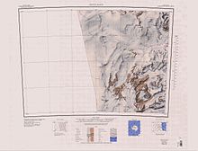
The Mawson Glacier (76°13′S 162°5′E / 76.217°S 162.083°E / -76.217; 162.083) is a large glacier on the east coast of Victoria Land, Antarctica, descending eastward from the Antarctic Plateau to the north of Trinity Nunatak and the Kirkwood Range, to enter the Ross Sea, where it forms the Nordenskjöld Ice Tongue.
[1] After the Last Glacial Maximum (LGM) there was dynamic retreat of the ice sheet covering the Ross Sea in the Mawson Glacier region.
Mawson Glacier flows east past the Walker Rocks and Mount Murray to its north and the Kirkwood Range to its south.
[3] It flows past Charcot Cove and Bruce Point to the north and the Oates Piedmont Glacier and Cape Day to its south, to terminate in the NordenSkjold Ice Tongue.
A large nunatak near the head of Mawson Glacier, about 6 nautical miles (11 km; 6.9 mi) northwest of Allan Hills.
An isolated peak, 2,010 metres (6,590 ft) high, which surmounts the central part of a ridge located at the icefalls at the head of Mawson Glacier.
A moraine located 8 nautical miles (15 km; 9.2 mi) west of Reckling Peak, the latter at the head of Mawson Glacier.
A large nunatak in the stream of the Mawson Glacier, about 5 nautical miles (9.3 km; 5.8 mi) north of the Convoy Range in Victoria Land.
A glacier just west of Cape Hickey, flowing southeast into Charcot Cove on the coast of Victoria Land.
Robert F. Scott, who named the feature for William S. Bruce, leader of the Scottish National Antarctic Expedition (1902–04).
It forms the outer, north portal of the re-entrant through which Mawson Glacier flows to the Ross Sea.
Named by US-ACAN in 1964 for Lt. John Hickey, USN, pilot with Navy Squadron VX-6, who participated in Topo North and South surveys in 1962.
A cape on the coast of Victoria Land 11 nautical miles (20 km; 13 mi) east of Mount Gauss.