Bulawayo
Bulawayo was founded by a group led by Gundwane Ndiweni around 1840 as the kraal of Mzilikazi, the Ndebele king and was known as Gibixhegu.
[6] His son, Lobengula, succeeded him in the 1860s, and changed the name to koBulawayo and ruled from Bulawayo until 1893, when the settlement was captured by British South Africa Company soldiers during the First Matabele War.
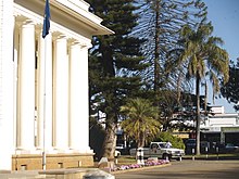
[9] Bulawayo's central business district (CBD) covers 5.4 km2 (2.1 sq mi) in the heart of the city and is surrounded by numerous suburbs.
Mbiko ka Madlenya Masuku, a trusted confidant of King Mzilikazi and leader of the Zwangendaba regiment, fought Prince Lobhengula as he did not believe that he was the legitimate heir to the throne.
The city of Bulawayo coincidentally has a similar name to the capital of the great Zulu warrior king Shaka ka Senzangakhona in Kwazulu, where Mzilikazi and his Khumalo clan and other Nguni people came from.
Britain made skilful use of private initiative in the shape of Cecil Rhodes and the Chartered Company to disarm the suspicion of her rivals.
[15] During the 1893 First Matabele War, British South Africa Company (BSAC) troops invaded and forced King Lobengula to evacuate his followers, after first detonating munitions and setting fire to the town.
Cecil Rhodes ordered the new settlement to be founded on the ruins of Lobengula's royal kraal, a typical action by a conquering power.
[18] In 1897, the new town of Bulawayo acquired the status of municipality in the British colonial system, and Lt. Col. Harry White was appointed as one of the first mayors.
By day, settlers could go to homes and buildings in the town, but at night they were forced to seek shelter in the much smaller laager.
The settlers and forces appealed for relief, and the BSAC sent additional troops from Salisbury and Fort Victoria (now Harare and Masvingo respectively) 500 kilometres (300 miles) to the north, and from Kimberley and Mafeking 1,000 km (600 mi) to the south.
Despite this, after the Second World War, prosperity and population growth revived, as the city became an industrial powerhouse, peaking during the Federal years as new markets opened in Malawi and Zambia.
In response, Bulawayo sought to re-invent itself as a 'heritage city', with its wide main streets refurbished and its Victorian architecture and industrial heritage preserved.
The city was also recognised as a centre of excellence in tertiary education and research, as the National University of Science and Technology, Zimbabwe was formed and expanded and other colleges growth also accelerated.
[20] Since the late 20th century, Bulawayo has suffered a sharp fall in living standards coinciding with the protracted economic crisis affecting the country.
The main challenges the city faces include underinvestment, declining infrastructure, de-industrialisation and the effects of corruption and nepotism.
These were designed to accommodate the ox-drawn carts, and to allow them to make a turn in the street, that were used as a primary means of transport when the town was planned and erected.
[citation needed] Many people resorted to farming, mining, and the black market for sustenance, while others depended on the little foreign currency that would be sent by family in other countries.
However, with inauguration of the Mnangagwa government, a new approach is seen by investors in the city who admire the already-available infrastructure; the huge workforce; and Bulawayo as a potential business hub.
[41] The city sits on a plain that marks the Highveld of Zimbabwe and is close to the watershed between the Zambezi and Limpopo drainage basins.
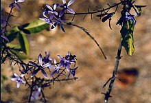
The city's average annual rainfall is 594 mm (23+3⁄8 in), which supports a natural vegetation of open woodland, dominated by Combretum and Terminalia trees.
[citation needed] Bulawayo experiences water shortages in drought seasons due to the overwhelming increase in population versus the static and sometimes decreasing capacity of the reserve dams.
The geographical factors causing water scarcity are rising temperatures, the area's high elevation and the arid environment of Matabeleland.
Sources such as groundwater and tap water are subject to pollution due to waste from burst sewers contaminating them.
Hartsfield was developed by Reg Hart, after whom the grounds were named and on which field many of southern Africa's greatest rugby players have competed.
Other football teams include Bantu Rovers, Chicken Inn, How Mine, Quelaton, and Bulawayo City (R).
Other important sporting and recreational facilities include: The city has a total road network of about 2,100 kilometres; 70 percent was declared in 2017 in a poor condition.
UMthunywa, a state-owned Ndebele-language newspaper, is also published in Bulawayo, where the majority of the population belongs to the Ndebele people.
The two radio stations, Skyz Metro FM, which is the first dedicated commercial radio station for the city and Khulumani FM, owned by the Zimbabwe Broadcasting Corporation are based in the city and offer their programming mainly in English and Ndebele and other languages spoken in the Matabeleland region.
The majority of the households rely on the South African-based satellite television distributor, DStv and OVHD for entertainment, news and sport across Africa and the world.