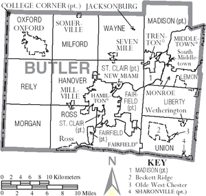
Butler County, Ohio
Butler County is part of the Cincinnati, OH-KY-IN Metropolitan Statistical Area.
Successive cultures of ancient Indigenous peoples of the Americas occupied areas of the county.
[6] The gravesites of David and Margaret Gregory indicate they were some of the first white settlers in the area in Liberty Township.
[6] Large portions of the county were held by non-resident owners, including 640 acres owned by future President William H Harrison.
[6] In 1830, Peter Schrock emigrated from France to live in Butler County.
Around the late 1860s or early 1870s, the community of Mauds was the sight of an attempt by a local entrepreneur to construct a mill that worked via perpetual motion.
A large crowd gathered to watch the mill start, and when it did not, laughter ensued.
[9] In the 1920s, Butler, Pickaway and Washington counties were central areas of the rural membership of the Ku Klux Klan in Ohio.
[10] In 1957, the Ohio Legislature established Hueston Woods State Park, which covers 3,596 acres in Butler and neighboring Preble County.
In addition to a 625-acre manmade lake, the park contains the 200-acre Hueston Woods, one of the last near-virgin growths of American beech and maple in Ohio.
[6] Before deforestation by settlers, much of the area was forests of American beech and maple trees.
[27] Prior to 1952, Butler County was strongly Democratic in presidential elections, only backing two Republican candidates for president from 1856 to 1948.
Starting with the 1952 election, it has become a Republican Party stronghold, with the sole Democrat to win the county in a presidential election since then being Lyndon B. Johnson in 1964 in the midst of his statewide and national landslide victory.
The service connects to the Southwest Ohio Regional Transit Authority in Springdale.