Caboloan
[1][2][3] Caboloan refers to the place where there is an abundance of bolo (Gigantochloa levis), a species of bamboo that abounds at the interior plains of Pangasinan.
[2]: 383 Caboloan's capital, Binalatongan (modern-day San Carlos), located near the Agno River delta, was said to be the largest settlement in the entire region, with over two thousand houses.
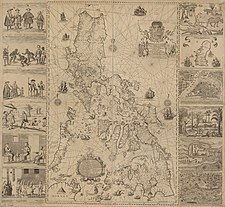
[2]: 381 According to local legend, the kingdom was said to have spanned Tarlac, Nueva Ecija, Zambales, La Union, Mountain Province and Pangasinan.
Afterwards, it was said that the Spaniards climbed at the foot of the Zambales Mountains to observe the kingdom of Ari Kasikis, where they witnessed a highly organized animistic ritual.
Bernardo de Santa Catalina, OP, as its first Vicar (equivalent to the office of the parish priest), together with Fr.
[4] At the start of the foundation, Binalatongan formerly included the towns of Calasiao, Binmaley, Bayambang, Malasiqui, Aguilar, San Carlos City, Urbiztondo, and Basista.
Diego de Rojas to the colonial governor in 29 March 1591, that the people of Caboloan preferred to dwell into the interior rather than settle at the royal encomiendas at the coasts, which were sandy and not suitable for their lifestyle.
[5] During the mid Spanish period, Binalatongan was well known as a site of many rebellions within Pangasinan, which included the revolts of Don Andres Malong (1660) and Juan de la Cruz Palaris (1762) during the Seven Years’ War.
[4] On 4 November 1718, in the aftermath of the rebellious period, the capital of Binalatongan would be transferred in what is now known as the poblacion of San Carlos, in which the town would also be renamed the same date.
[2]: 382 [3] While disadvantaged with the lack of maritime commerce, Caboloan had an abundance of water supply and arable land, as well as other raw materials.
It is said that by the time that the Spaniards had arrived, that the people of Caboloan were already wearing gold jewelry and had a well-developed system of agriculture and farming methods.