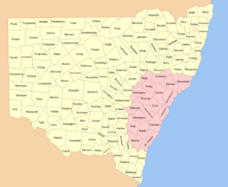
Lands administrative divisions of New South Wales
They were in the approximate area of the present day cadastral units except that some of them were larger and took up land which was in 1834 assigned to other counties.
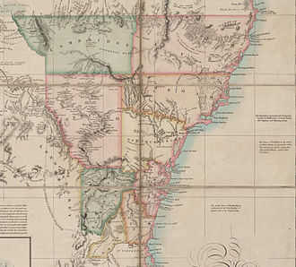
Instructions were given to Governor Brisbane in 1825 to survey New South Wales and divide it into counties of various sizes, hundreds, and parishes between 15 and 25 square miles (40 and 65 km²).
The counties have little official function and are only now used for land titles and geographic surveying, and as an area of coverage within some industrial awards.
Yancowinna County is also legally the only part of the state in the South Australian time zone.
Genealogy records from the 19th and early 20th centuries for New South Wales commonly use the town name followed by the county.
[4] Parts of the land which were outside the Nineteen Counties were divided into squatting districts in the early 19th century [1].