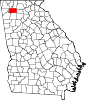
Calhoun, Georgia
A small town called "Dawsonville" was created and founded in Gordon County, named for the owner of an early general store.
Voters chose a site along the railroad, so the inferior court designated Calhoun as county seat in 1851.
[10] On January 5, 1861, Georgia seceded from the Union as a prelude to the American Civil War.
[11] Calhoun is located west of the center of Gordon County at 34°30′0″N 84°56′33″W / 34.50000°N 84.94250°W / 34.50000; -84.94250 (34.499898, -84.942584),[12] along the Oostanaula River where it is joined by Oothkalooga Creek.
U.S. Route 41 passes through the center of town as Wall Street, and Interstate 75 runs along the eastern edge of the city, with access from Exits 310, 312, 315, 317, and 318.
Georgia State Route 156 runs west out of town as West Line Street, leading 18 miles (29 km) to Armuchee, and heads east out of town as Red Bud Road, leading 8 miles (13 km) to Red Bud.
Georgia State Route 136 (North River Street) leads northwest 30 miles (48 km) to LaFayette.
[13] The climate in this area is characterized by relatively high temperatures and evenly distributed precipitation throughout the year.
[14] As of the 2020 United States Census, there were 16,949 people, 6,088 households, and 4,001 families residing in the city.
[22] The twice-weekly Calhoun Times established in 1870 is Gordon County's oldest operating business.
[24] With home delivery print editions each Wednesday and Saturday, the paper also has a website and various social media.