California State Route 56
Continuing east, the route then has an interchange at Carmel Creek Road, which provides access to the nearby San Diego Jewish Academy, and proceeds eastward through a residential area.
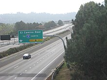
[2] SR 56 meets Carmel Valley Road and curves northward, passing Canyon Crest Academy before turning southeastward.
The route passes over McGonigle Creek before intersecting Camino Del Sur, which serves the nearby Westview High School.
Southeast of Camino Del Sur, SR 56 curves back east, passing under Carmel Mountain Road without an exit.
[15] Opposition to the western end of the freeway related to concerns about destruction of "farmland, marshland, and willow scrubland", the habitat of the endangered least Bell's vireo.
[16] The San Diego City Council voted against such widening of Carmel Valley Road on April 12, citing the environmental concerns.
[22] The California Coastal Commission approved the construction on September 13, and several local residents representing both sides of the debate attended the meeting in Marina del Rey.
[23] Construction on the predecessor of SR 56 began on November 16, 1987, the Newland-California Company paying for the work as a local developer.
[29] On July 16, 1992, the Sierra Club withdrew its lawsuit after the City of San Diego agreed to work to keep the Peñasquitos Lagoon flowing to the ocean and to restore a wetland area.
[31] The Del Mar Conservancy suit continued, and the plaintiffs requested a court order to stop construction.
[32] In 1993, citizens complained that funds were being diverted from a recreational park to build the freeway, possibly hindering the development of a new elementary school.
[35][36] The freeway is named after Ted Williams, a Hall of Fame baseball player born in San Diego[37] who played for the Boston Red Sox during his 21-year career.
[41] Lionel Van Deerlin alleged that Councilwoman Abbe Wolfsheimer nominated Wilson for the honor as political ammunition against Councilman Ron Roberts.
[25] Since the proposed route passed through the open area between Carmel Valley and Rancho Peñasquitos, revenue from the Proposition A sales tax hike could not be used.
[28] Two years later, County Supervisor Pam Slater briefly proposed making SR 56 a toll road in order to raise funds for construction.
The San Diego County Board of Supervisors cancelled the plans in February 1994, respecting the wishes of the city of Encinitas.
[52] One of them was chosen in June 1998 by the San Diego City Council, amid concerns that by moving the route away from "environmentally sensitive canyons", the freeway would be closer to residences.
[18] The California Coastal Commission approved the extension on May 10, 2000, after residents lost two lawsuits relating to the proximity of the freeway.
[70] Concerns about the lack of a ramp from westbound SR 56 to northbound I-5 date back from 1988, because of a projected increase of traffic on local Carmel Valley streets.
[73] On June 13, 2012, Caltrans held a public forum to discuss five proposals to address the missing ramps at the western terminus: A final environmental document was scheduled to be released in the middle of 2016.
[75] In the meantime, Caltrans began studies relating to widening the route to three lanes in each direction, as called for by the 2050 regional plan;[76] by late 2022, plans had been developed to add high-occupancy vehicle lanes between El Camino Real and Carmel Country Road starting in April.
[77] On April 24, 2023, the San Diego City Council voted unanimously to allocate $22.5 million and approve the construction of HOV lanes.