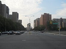
Canarsie, Brooklyn
In the 1970s, racial tensions developed around an argument over the zoning of the area's schools, and in the aftermath, Canarsie became a mainly black neighborhood with a high West Indian population in the late 1990s.
[18] Prior to European settlement, Canarsie featured the only large swath of uplands along the Jamaica Bay coast within the town of Flatlands.
[12]: 11 [26] The only way to Canarsie was by taking a train to Jamaica and transferring to a stagecoach, where passengers would endure a "long and uncomfortable ride" through the marshy woodlands that the road winded through.
The correspondent wrote that "it has ample hotel accommodations for boarders or casual visitors, and all it needs is a good roadway along the waterside for promenade and drive.
One proposal entailed extending a railroad trestle into Jamaica Bay to shorten the ferry trip, while the other involved constructing a narrow-gauge railway that ran to Broad Channel, Queens.
[12]: 44 An 1882 newspaper article observed that after traveling to Canarsie "through a tract of country that looked like one vast lawn of green velvet", visitors could hire yachts or rowboats, or just breathe the fresh air.
[33] In 1883, a large double-decker barge for theatrical and musical performances, called the "Floating Pavilion", was permanently anchored 0.75 miles (1.21 km) off the Canarsie shore.
[12]: 47 A 1900 magazine article described the Canarsie bay shore as "a level expanse of marshy meadowland indented with shallow inlets and dotted with boathouses, fishing huts, and boat builders' cabins perched high and dry on wooden piles.
[12]: 65 The Canarsie Line faced a steep drop in patronage in 1895, when frequent trolley service started operating to Coney Island.
[12]: 47 The owners hoped that the five-cent fare of the Canarsie Railroad would draw riders who would otherwise pay 10 cents to go to the Coney Island amusement area.
[43][41] In August of that year, the Golden City Construction was leased to the Canarsie Amusement Company, who planned to make the park one of the world's largest.
A writer for The New York Times later noted that "the horses were carved in Coney Island style, which eschewed the look of docile ponies and prancing fillies and produced much more muscular, ferocious creatures with bared teeth and heads often lifted in motion.
[12]: 71 In January 1931, the New York City Board of Estimate approved a plan to build railroads on both sides of Paerdegat Basin, connecting the LIRR to Canarsie Pier on the east and to Floyd Bennett Field on the west.
[43] In the spring of 1940,[61] when the Belt Parkway was built through the area, the carousel was moved to Baldwin, on the border abutting Freeport, on Long Island.
[46] The Works Progress Administration, in conjunction with the city's Departments of Parks and Docks, built a recreation building on Canarsie Pier in 1941.
[12]: 48 Ferry service at Canarsie Pier also withered away after the opening of the Marine Parkway–Gil Hodges Memorial Bridge in 1937, which connected Brooklyn to the Rockaways directly.
The Guide further described the burned-down amusement park, the ramshackle shacks, and Canarsie's "weedy lots and small truck farms cultivated by Italians".
[71] Starting in the 1950s, a series of suburban waterfront communities were being rapidly developed in Southeast Brooklyn, including in present-day Bergen Beach, Canarsie, and Mill Basin.
[80] In conjunction with this development, the federal and city governments each awarded hundreds of thousands of money toward improving parks and beaches in Canarsie.
[89] These delays held up construction for nine years: in March 1966, an aide to Mayor John Lindsay reported that "not one spadeful of dirt" had been excavated on the site.
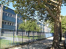
[103] By the end of its first year, the principal was stepping down, and a coalition called "Friends of South Shore" had formed to protest the lack of resources or opportunities available at that school.
[140] In the aftermath of Hurricane Sandy, the Federal Emergency Management Agency started redrawing flood-risk maps in New York City to account for climate change.
[10] Canarsie also contains a gated community, the Seaview Estates condominium complex, which has five buildings as well as its own tennis court and swimming pool.
[143] The Brooklyn Terminal Market is located adjacent to Canarsie Plaza, and sells horticultural items such as plants, trees, and fruits.
[149]: 14 The concentration of fine particulate matter, the deadliest type of air pollutant, in Canarsie and Flatlands is 0.0071 milligrams per cubic metre (7.1×10⁻⁹ oz/cu ft), lower than the citywide and boroughwide averages.
[165] Canarsie Pier, a fishing spot and recreation area on Jamaica Bay, is located in the southern part of the neighborhood at the end of Rockaway Parkway.
The park was expanded in 1934 after the city purchased land from the Department of Docks, and a playground was built at Seaview Avenue and East 93rd Street in 1936.
[140] This renovation, and the upkeep of other parks in Canarsie, was attributed to an infusion of $13 million in funds from City Councilman Lewis A. Fidler, who represented Community Board 18 at the time.
[173] Sledge Playground is located on East 95th Street between Holmes Lane and Avenue L. The park originally opened in 1934 on land that was acquired by the city in 1924.
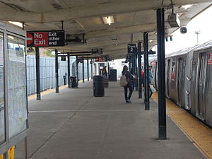
[176][17] The subway system's only level crossing was located at East 105th Street[177] until it was closed by 1973[178] as part of the Flatlands Industrial Park project.