Cap-Rouge, Quebec City
The site of the first attempted permanent French settlement in North America, Charlesbourg-Royal, is located at the confluence of the Rivière du Cap Rouge and the Saint Lawrence River.
The village formed is served by the parishes of Ancienne-Lorette in (1678) to the north; of Saint-Augustin in (1691) on the west; and of Sainte-Foy (1698) in the east.
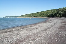
[a 1] The name of Cap-Rouge, meaning "red cape", comes from its cliffs facing the Saint-Lawrence river and made of schist rock bearing a reddish tint.
The other main topographic feature of Cap-Rouge is the Rivière du Cap Rouge valley where are concentrated some historic buildings as well the archeological remains of a pottery workshop active from 1860 to 1892.
[3] The Cap-Rouge area is located to the south of the Canadian Shield and Laurentian Mountains, at the confluence of the geological regions of the Saint Lawrence Lowlands and of the northern Appalachians.