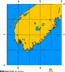
Cape Sable Island
Historically, the Argyle, Nova Scotia region was known as Cape Sable and encompassed a much larger area than simply the island it does today.
Cape Sable was first inhabited by the Mi'kmaq, who called the area and generally the island itself "Kespoogwitik", meaning "where the land ends".
[1] Cape Sable Island was charted by explorers from Portugal who named it "Beusablom", meaning "Sandy Bay".
During the Anglo-French War (1627–1629), under Charles 1, by 1629 the Kirkes took Quebec City, Sir James Stewart of Killeith, Lord Ochiltree planted a colony on Cape Breton Island at Baleine, and Alexander's son, William Alexander, 1st Earl of Stirling established the first incarnation of "New Scotland" at Port Royal, Nova Scotia.
Charles 1's haste to make peace with France on the terms most beneficial to him meant that the new North American gains would be bargained away in the Treaty of Saint-Germain-en-Laye (1632).
[8] La Tour retired to Cap de Sable with his third wife Jeanne Motin, wed in 1653, and died in 1666.
During this time period, Acadians participated in various militia operations against the British and maintained vital supply lines to the French Fortress of Louisbourg and Fort Beausejour.
[13] The Acadians and Mi'kmaq from Cape Sable Island raided the Protestants at Lunenburg, Nova Scotia numerous times.
[14] In April 1756, Major Jedidiah Preble and his New England troops, on their return to Boston, raided a settlement near Port La Tour and captured 72 men, women and children.
Major Henry Fletcher led the 35th Regiment and a company of Joseph Gorham's Rangers to Cape Sable Island.
[16] En route to the St. John River Campaign in September 1758, Moncton sent Major Roger Morris, in command of two men-of-war and transport ships with 325 soldiers, to deport more Acadians.
MacDonald, wrote to Major John Small, "McKinnon was embarrassed by the praise of the General and requested it not be inserted in the record since he only did his duty.
Due to surrounding cool ocean waters, summer thunderstorms are very rare, but low clouds and fog are common.
The island lies in the path of Nor'easters, which reach maximum frequency and intensity in winter, meaning this area's wettest months on average are December and January.
Tropical weather systems, including, rarely, hurricanes can occur occasionally, generally entering the area from the south or southwest, with the greatest risk in September and October.
Over the years the Cape's storms, and the close proximity of the island to shipping routes, has led to a substantial number of shipwrecks.
The unique climate, abundant tidal marshes, and geographical location on the north–south flight path of numerous migratory waterfowl have led to it being designated an Important Bird Area.