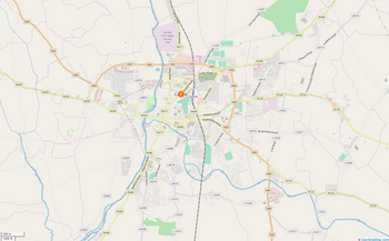
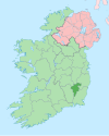
Carlow
[3] The River Barrow flows through the town and forms the historic boundary between counties Laois and Carlow.
According to logainm.ie, the first part of the name derives from the Old Irish word cethrae ("animals, cattle, herds, flocks"),[8] which is related to ceathar ("four") and therefore signified "four-legged".
Evidence shows that human occupation in the Carlow county area extends back thousands of years.
The most notable and dramatic prehistoric site is the Browneshill Dolmen – a megalithic portal tomb just outside Carlow town.
Old Leighlin was the site of one of the largest monastic settlements in Ireland and the location for a church synod in 630 AD which determined the date of Easter.
St Comhgall built a monastery in the Carlow area in the 6th century, an old church building and burial ground survive today at Castle Hill known as Mary's Abbey.
Carlow Castle was constructed by William Marshal, Earl of Striguil and Lord of Leinster, c. 1207 – c. 1213, to guard the vital river crossing.
This imposing structure survived largely intact until 1814 when it was mostly destroyed in an attempt to turn the building into a lunatic asylum.
Following independence in the early 1920s, the new government of the Irish Free State decided to establish a sugar-processing plant in Leinster.
Carlow was chosen as the location due to its transport links and large agricultural hinterland, favourable for growing sugar beet.
In 1650, during the Cromwellian conquest of Ireland, Carlow was besieged and taken by English Parliamentarian forces, hastening the end of the Siege of Waterford and the capitulation of that city.
According to Celtic scholar Nicholas Williams, the Irish spoken in County Carlow seems to have belonged to a central dialect stretching from west Connacht eastwards to the Liffey estuary.
Evidence from place names suggests that Old Irish cn- had become "cr-" in parts of Carlow, like all Gaelic speech outside of Munster and Ossory.
It has been claimed by Bride de Roiste of Glór Cheatharlach that there is more Irish spoken in Carlow than in certain Gaeltacht districts.
[21] Carlow industry has come a long way since the early 20th century when the town became the centre of Ireland's slow process of industrialisation with the creation of the Irish Sugar Company.
It closed on 11 March 2005 as the management of the parent company Greencore decided that it was no longer economical to run the factory nor was it viable to upgrade the facility.
One of the traditional, principal employers in Carlow was OralB Braun, which had a large factory producing mostly hairdryers and electric toothbrushes; however, this closed in 2010.
Since opening its doors in October 2003 Fairgreen Shopping Centre has also played a large part in employment in the area; Tesco, Heatons, Next, New Look and River Island are the main tenants.
Pharmaceutical giant Merck & Co. employs more than 500 people at its manufacturing campus in Carlow and is expanding with a new facility focused on oncology biologics.
These transport links have helped Carlow to become a successful satellite town of Dublin in recent years.
The establishment of the Institute of Technology, Carlow, has also helped drive growth in the area and encouraged many school leavers to remain in the town.
[32][33][34][35] The route consisted of several laps of a circuit passed-through Kilcullen, Kildare, Monasterevin, Stradbally, Athy, Castledermot and Carlow.
Met Éireann records climate data for Carlow from their station at Oak Park, situated at 61 m (200 ft) above sea level.