Cecilia, Louisiana
The Atakapa lived in what is now Southwest Louisiana and Texas, and had a trading post at St. Martinville, before French settlers took over the land.
[4] Pierre Guidry, the first settler of Cecilia,[5] acquired three tracts of land from Mrs. Joseph Alexander Declouet in 1791.
This name was dropped when postal authorities began to confuse it with the LaPlace in St. John the Baptist Parish.
[9] On April 19, 1964, dedication ceremonies were held in a grove of live oaks on the banks of Bayou Teche about three miles (4.8 km) from Cecilia on Highway 328 to mark Hebert's grave.
The marker reads as follows: "Approximately 100 yards (91 m) to the west is the probable resting place of General Louis Hebert, C. S. A.
General Hebert taught at Huron Plantation near Cecilia and tutored children of Vincent Barras in St. Martinville.
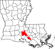
[10] Cecilia is located at 30°20′11″N 91°50′52″W / 30.33639°N 91.84778°W / 30.33639; -91.84778 (30.336379, -91.847867), in south central Louisiana;[11] it lies within Acadiana, and the Lafayette metropolitan area.
According to the United States Census Bureau, the CDP has a total area of 2.1 square miles (5.4 km2), all land.
Official Report Relative to the Conduct of Federal Troops in Western Louisiana, During the Invasions of 1863 and 1864 – Compiled and Sworn Testimony Under the Direction of Gov.