Centro (Coronel Fabriciano)
The installation of the Acesita (now Aperam South America) and Usiminas industrial complexes, located in the neighboring municipalities of Timóteo and Ipatinga, respectively, favored urban development and boosted commercial importance.
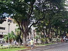
It also houses several monuments of cultural and historical importance, such as the Mother Church of Saint Sebastian, Colégio Angélica, Sobrado dos Pereira and Estação Square.
[5] The settlement of the current Centro began at the end of the 1910s with the resumption of construction of the Vitória-Minas Railroad (EFVM), interrupted in Belo Oriente.
The area was known as Barra do Calado, as it was located near the mouth of the Caladão Stream on the Piracicaba River, where goods and people were shipped to neighboring settlements.
[6][7] In 1928, Sobrado dos Pereira, the first masonry building in the town besides the railway terminal, was built on the then Rua de Baixo and housed the first commercial establishment.
Associated with the presence of the railway station, Rua de Baixo became the town's main commercial center, favored by the four daily stops of EFVM passenger trains, which brought consumers from other cities every day.
In 1936, an office of the Companhia Siderúrgica Belgo-Mineira was established to centralize logging and coal production in the Doce River Valley region, which resulted in demographic and structural growth.
[7][6] Later, other establishments were built, such as: the EFVM administrative unit; the Sete de Setembro Club, the city's first nightclub; and the Banco da Lavoura, the first bank branch.
[7][6] The installation of the Usiminas and Acesita (now Aperam South America) industrial complexes also favored urban development, but with the political emancipation of Ipatinga and Timóteo in the 1960s, the companies became part of these municipalities, respectively.
[7][6][8] Located between the railway terminal and the commercial center, Pedro Nolasco Street became the main bus stop for urban and interurban public transport.
[20][21] In 2010, the Brazilian Institute of Geography and Statistics (IBGE) estimated that 2,799 inhabitants lived in the neighborhood, which is comparable to cities in Minas Gerais such as Rio Doce and Carmésia.
Governador José de Magalhães Pinto Avenue connects the Centro to the neighborhoods of the Senador Melo Viana district, the most populous region of the municipality.
The Pastor Pimentel Interchange, which represents the boundary between the central region and Giovannini, is the junction of Magalhães Pinto and Presidente Tancredo de Almeida Neves avenues.
One of the oldest religious buildings in the Vale do Aço Metropolitan Region is the Mother Church of Saint Sebastian, inaugurated in 1949 to replace the old one, which was about to collapse.
[35] Located at the Pastor Pimentel Interchange, the Terra Mãe Monument was built in the 1990s in honor of the 50th anniversary of Coronel Fabriciano's political emancipation.
Estação Square, located between Pedro Nolasco Street and Rubem Siqueira Maia Avenue, can accommodate up to 15,000 people and was built in 2008 on the site of the city's urban terminal.
Louis Ensch Square has a tree-lined area in front of the João Sotero Bragança Building, the former city hall, and the Monument to Human Rights, erected in 1999.