Changchun
Changchun was initially established on imperial decree as a small trading post and frontier village during the reign of the Jiaqing Emperor in the Qing dynasty.
In 1800, the Jiaqing Emperor selected a small village on the east bank of the Yitong River and named it "Changchun Ting".
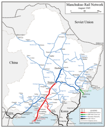
[16] The next station just a short distance to the south—the new "Japanese" Changchun station—became the first station of the South Manchuria Railway,[17] which now owned all the tracks running farther south, to Lüshun, which they re-gauged to the standard gauge (after a short period of using the narrow Japanese 3 ft 6 in (1,067 mm) gauge during the war).
[19] It was the worst-ever recorded outbreak of pneumonic plague which was spread through the Trans-Manchurian railway from the border trade port of Manzhouli.
[21] The Treaty of Portsmouth formally ended the Russo-Japanese War of 1904–05 and saw the transfer and assignment to the Empire of Japan in 1906 the railway between Changchun and Port Arthur, and all its branches.
[citation needed] At the beginning of 1907, as the prelude to, and preparation for, the invasion and occupation of China, Japan initiated the planning programme of the SMRAA, which embodied distinctive colonial characteristics.
The guiding ideology of the overall design was to build a high standard colonial city with sophisticated facilities, multiple functions and a large scale.
[citation needed] Accordingly, nearly ¥7 million on average was allocated on a year-by-year basis for urban planning and construction during the period 1907 to 1931.
[citation needed] The city's role as a rail hub was underlined in its planning and construction, the main design concepts of which read as follows: under conventional grid pattern terms, two geoplagiotropic boulevards were newly carved eastward and westward from the grand square of the new railway station.
With the new Changchun railway station as its centre, the urban plan divided the SMRAA into various specified areas: residential quarters 15%, commerce 33%, grain depot 19%, factories 12%, public entertainment 9%, and administrative organs (including a Japanese garrison) 12%.
[24] Perceiving Changchun as a tabula rasa upon which to construct new and sweeping conceptions of the built environment, the Japanese used the city as a practical laboratory to create two distinct and idealized urban milieus, each appropriate to a particular era.
Yet, while the façades in the city and later the capital contrasted markedly, along with the attitudes of the state they upheld, the shifting styles of planning and architecture consistently attempted to represent Japanese rule as progressive, beneficent, and modern.
The development of Changchun, in addition to being driven by the railway system, suggested an important period of the Northeast modern architectural culture, reflecting Japanese urban design endeavours and revealing that county's ambition to invade and occupy China.
Changchun expanded rapidly as the junction between of the Japanese-owned South Manchurian Railway and the Russian-owned Chinese Eastern Railway, remaining the break of gauge point between the Russian and standard gauges into the 1930s,[25] On 10 March 1932 the capital of Manchukuo, a Japan-controlled puppet state in Manchuria, was established in Changchun.
[26] The city was then renamed Hsinking (Chinese: 新京; pinyin: Xīnjīng; Wade–Giles: Hsin-ching; Japanese:Shinkyō; literally "New Capital") on 13 March.
The Bureau of capital construction (国都建设局; 國都建設局; Guódū jiànshè jú) which was directly under the control of State Council of Manchukuo was established to take complete responsibility of the formulation and the implementation of the plan.
[29] Kuniaki Koiso, the Chief of Staff of the Kwantung Army, and Yasuji Okamura, the Vice Chief-of-Staff, finalized the plan of a 200 km2 (77 sq mi) construction area.
By 1934 Hsinking was known as the Forest Capital with Jingyuetan Park built, which is now China's largest Plantation and a AAAA-rated recreational area.
[30] In accordance with the Metropolitan Plan of Great Hsinking, the area of publicly shared land (including the Imperial Palace, government offices, roads, parks and athletic grounds) in Hsinking was 47 km2 (18 sq mi), whilst the area of residential, commercial and industrial developments was planned to be 53 km2 (20 sq mi).
[47] Soviet Union lent assistance during these early years, providing technical support, tooling, and production machinery.
Winters are long (lasting from November to March), cold, and windy, but dry, due to the influence of the Siberian anticyclone, with a January mean temperature of −14.3 °C (6.3 °F).
Summers are hot and humid, with a prevailing southeasterly wind due to the East Asian monsoon; July averages 23.7 °C (74.7 °F).
[61] It was originally located in the centre of the old town, but, after nine years of construction, a new building for the museum's collections was completed in 2016 on the city's outskirts in Nanguan District near Jingyuetan Park.
Changchun is home to China's biggest vehicle producer FAW (First Automotive Works) Group, which manufactured the first Chinese truck in 1956 and car in 1958.
In November 2016, CRCC Changchun unveiled the first bullet train carriages in the world with sleeper berths, thus extending their use for overnight passages across China.
Nicknamed Panda, the new bullet trains are capable of running at 250 km/h, operate at −40 degrees Celsius, have Wi-Fi hubs and contain sleeper berths that fold into seats during the day.
The development zone is situated in the southwest of the city and is adjacent to the China First Automobile Works Group Corporation and the Changchun Film ThemeCity.
The zone is devoted to developing five leading industries: namely automotive parts and components, photoelectric information, bio-pharmaceutical, fine processing of foods, and new building materials.
According to a draft plan up until 2020, the downtown area will expand southwards to form a new city center around Changchun World Sculpture Park, Weixing Square and their outskirts, and the new development zone.
5The claimed province of Taiwan no longer have any internal division announced by Ministry of Civil Affairs of PRC, due to lack of actual jurisdiction.