Chenango Canal
[2] Built and operated in the mid-19th century, it was 97 miles long and for much of its course followed the Chenango River, along New York State Route 12 from Binghamton on the south end to Utica on the north.
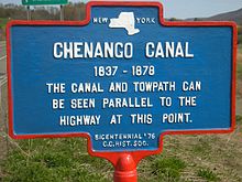
It operated from 1834 to 1878 and provided a significant link in the water transportation system of the northeastern U.S. until supplanted by the region's developing railroad network.
The excavation began in 1834 and was largely done by Irish and Scottish immigrant laborers, digging by hand, using pick and shovel, chipping through rock and wading through marsh.
[4] Skilled workers came from the completed Erie Canal project and brought new inventions, such as an ingenious stump-puller, which used oxen or mules for animal power.
This project had to succeed by getting almost 23 miles of waterway up an incline with a 706' elevation, to the summit level in Bouckville, and back down a descent of 303' to the Susquehanna river in Binghamton.
At a time when there was only one engineering school in the country (Rensselaer Polytechnic Institute ((1824)), and hydrology was not yet a scientific discipline, Jervis and his team were able to design a complex waterway that was considered the best of its day.
The main artery Erie Canal was built between 1817 and 1825 and provided the key link in a water highway to what would become the Midwestern United States, connecting to the Great Lakes at Buffalo.
The Erie made use of the favorable conditions of New York's unique topography which provided that area with the only break in the Appalachian range—allowing for east-west navigation from the Atlantic coast to the Great Lakes.
It was intended to connect Binghamton and surrounding communities, by water route, to the port of New York City and to the Great Lakes States.
With the coming of the Chenango Canal, Port Crane, being located on the line of this waterway, developed rapidly, with stores, hotels, boat yards and repair and dry docks being built in that village.
But the connecting canals in the southern part of the state and in northern Pennsylvania were never fully completed nor totally operational.
Most significantly, the Chenango Co. had difficulty performing its regular maintenance due to the often prohibitively high repair costs.
Before the canal was built, it took between 9 and 13 days to ship goods by wagon from Binghamton to Albany, for a cost of $1.25 per 100 pounds.
The packet boats and barges were drawn at an average speed of four miles an hour by horse or mule teams on the towpath.
Each barge had two cabins: one at the bow to stable the animals, usually horses or mules, that pulled the boat, and one at the stern which served as a living quarters for the captain and crew, and sometimes a whole family.
Mills and factories sprang up along the southern end of the canal, while stores and hotels arose all along the retail corridor.
[8] Numerous and varied supporting businesses also flourished, including taverns, inns and boat yards- for building and repair.
Before the Chenango Canal was built, much of the Southern Tier and Central New York was still considered to be frontier.
The people petitioned for a canal corridor so that they could benefit from such things as efficient clean-burning coal, which had to be shipped from Pennsylvania.
It is believed that Phillip Armour, the millionaire meat packer from Madison County, had first worked as a mule driver walking the Chenango Canal.
When the freeze was just beginning, Bartlett would bring up several teams, hitch them to a bunch of stumps and drag through the canal to break the ice so boats could get lumber to his mill.
We'd boat grain up to the big stills at Hamilton, Pecksport, Bouckville and Solsville and bring back loads of whiskey which the merchants sold or shipped away.
[5]Opened in 1834, Chenango Canal was a necessary link in the interconnecting transportation system in New York, for which the need was well-recognized at that time.
After 1900, a surviving stretch of the then-closed canal gained notoriety owing to its use to transport contraband through the town of Hamilton.
Surprisingly, over five million dollars worth of illegal goods were confiscated, from 1900 until about 1930, in what would become one of the most famous water-borne transportation enforcements of that time.
[10] Portions of the old channel, stone aqueducts, locks, and other structures still remain in place along its route, and are visible in several locations.
Chenango Canal Summit Level is a national historic district located in the vicinity of Bouckville in Madison County, New York, United States.
The contributing structures are the canal prism and adjacent tow path, the remaining portions of the aqueduct that carried the Chenango over the Oriskany Creek, and a pair of stone bridge abutments.
They hope to collect historical artifacts for public display and establish what is left of the Chenango Canal in that area as a Madison County park.
Calling it the Chenango Connections Corridor, the area's citizens are now working in conjunction with the NYS Office of Parks, Recreation, and Historic Preservation; the NYS Canal Corporation; and Parks & Trails New York staff, as part of the HTHP program, to shape a vision and implementation plan for the corridor that spans three counties and multiple villages and towns.