Cibolo Creek
Additionally, numerous human settlements have been founded on the creek, such as Boerne, Fair Oaks Ranch, San Antonio, Bulverde, Bracken, Selma, Schertz, Universal City, Cibolo, Zuehl, New Berlin, La Vernia, Cestohowa, Kosciusko, Sutherland Springs and Panna Maria.
It has been judged as a "scenic" and "picturesque" stream,[2] especially in the upper reaches, as steady flows travel through deep canyons and rocky flats to form falls.
The steady flow begins to dissipate in certain areas as it approaches Camp Bullis[7] in northern San Antonio, leaving dry patches that reveal a rocky bottom.
[10] As it meanders through Wilson and Karnes Counties, passing Zuehl, New Berlin, La Vernia, Sutherland Springs, and Cestohowa, Cibolo Creek meets with the San Antonio River near the ghost town of Helena.
[2] The drainage basin of Cibolo Creek is located in the lower reaches of the Cretaceous Glen Rose Formation along the southeastern edge of the Edwards Plateau.
Near the recharge zone, distributaries of the creek have carved deep canyons in the landscape of the Texas Hill Country, forming what is known as the Cibolo Canyonlands.
The Cibolo Nature Center claims 1,300 acres (5.3 km2; 2.0 sq mi) of the watershed, to protect the water quality from the hazards of rapid development and population growth.
[18] It is thought that Coahuila Governor Alonso de Leon had one of the earliest encounters with the creek in 1689 while on the first Spanish entrada to explore the French-claimed lands believed to lie beyond the Nueces River.
Records suggest a camp was set up on the creek, identified as Arroyo del Leon, coined from the discovery of a dead mountain lion along the banks.
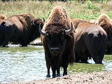
The Native Americans are believed to have used the steeply banked bluffs along the creek as hunting grounds, chasing herds of buffalo into the bed where the creatures would fall to their deaths.
The group's lieutenant led an offensive against the patrols, and forced the Mexicans to retreat to San Antonio, allowing the Texans to march to Salado Creek.
Seguín set the post after being ordered to withdraw from San Antonio, with a regiment that severely lacked resources, including clothing and horses.
[31] Another plan to create a Cibolo Reservoir near Stockdale aimed to control flooding and provide fresh water met fierce opposition from local citizens concerned about the destruction of historic sites along the creek, and the loss of taxable land.
[33] Camp Bullis, a military training ground found along the stream in north Bexar County, allows hunting for deer and other game, as well as separate locations for archery and fishing.