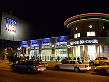
Cityscape of Lexington, Kentucky
Because the farmland in the southern part of the county consisted more of tobacco farms than pastures for raising horses and thus was considered "replaceable", most of Lexington's growth has been historically concentrated south of the downtown area.
Today, new development continues to the Madison and Clark County lines in a southeasterly direction along the Interstate 75 and US 60 (Winchester Road) corridors.
In addition to rampant suburban growth, downtown Lexington is seeing a large building boom, with the revitalization of many historical structures and the construction of many new ones.
Much of the development utilizes urban infill techniques such as the filling in of parking lots and high-density or out-of-character structures.
The Lexington Financial Center, a 410 feet (125 m), 31 floor highrise that was completed on a site bounded by South Mill, Main and Vine Streets.
The near-160,000-square-foot (15,000 m2) facility is on a 6-acre (24,000 m2) plot, with large windows that offer an interior glimpse at the massive printing presses and other industrial equipment.
[2] The three-story glass and granite structure, completed for $2.1 million, was a construction project by the Webb Cos.; it was formerly a Kentucky Central Life Insurance Co. parking lot.
[2] A stately brick structure outlined in copper, it was constructed near the Woodlands, and features 35,000 sq ft (3,300 m2).
One major project that was only partially realized was the Lexington Transit Center development, which was to include a residential apartment structure on top between High and Vine Streets.
[9] It would have been constructed around the Blue Grass Shade Company at 124 South Mill and McAdams and Morford Drugs at 200 West Main Street.
The Phoenix Hotel was demolished in preparation for the skyscraper, however, it was never constructed; for years a pile of rubble stood marking the site.
Envisioned by two University of Kentucky professors, the civic space would have been located 14.5 feet (4.4 m) above the Harrison Avenue viaduct (now Martin Luther King Drive), and would have included a bandstand for live music, an outdoor cafe with meeting space, and a display area for local art scene.
It was loosely modeled after the Belvedere along Interstate 64 in Louisville, Kentucky and Fountain Square in Cincinnati, Ohio.
As the cost of land within the urban service boundary of Fayette County increases due to the diminishing amount of plots appropriate for development, and as people's interest in living downtown has seen a resurgence, several new projects are either in planning, under construction, or have already been finished.
It is a residential and commercial project that will feature a tall sweeping spire and a clock, and will encompass an entire city square block.
The Chevy Chase district, centered around the intersection of East High Street, Euclid Avenue, and Fontaine Road, hosts a collection of small boutique shops, restaurants, and a television station.
Constructed in 1968, the 250-foot (76.2 m) building houses faculty offices, numerous conference rooms, and several computer labs.
Completed in 1967 along with the rest of what had been the university's largest student housing area, the Kirwan–Blanding Complex, the towers were 264 feet (80.5 m) tall.