Clare, South Australia
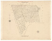
The layout of the town's road system was apparently designed by a draughtsman in Adelaide, without any knowledge of the local geography.
[citation needed] There are several roads in Clare that end abruptly at a cliff face, only to continue again at the top of the cliff, e.g. Wright Street to the top of Billy Goat Hill, and continued as Wright Lane below, running by Woolworths.
It was proclaimed by Governor George Grey and named for Edward Stanley, Secretary of State for the Colonies from 1841 to 1845.
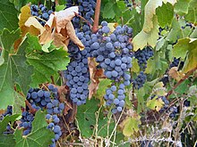
[11] Clare Valley wines exported (in casks) were mainly Stanley port, with "its unique and palatable flavor".
It has two supermarkets, many other specialty stores, two public and two private schools, three hotels, two motels, a caravan park, race course and showground.
Clare has become recognised for its 'experiences', including the Riesling Trail walking and cycling route from 9 km north of Clare to Auburn (25 km), on the former railway alignment, so named as it weaves past vineyards and wineries, and continuing to Riverton as the Rattler Trail.
[16] Clare is the starting point of the Lavender Federation Trail which traverses the eastern side of the Mount Lofty Ranges past the Barossa Valley through to Murray Bridge.
A further dozen or more wineries surround the town: including Taylors, Kirrihill, Kilikanoon, and Shut The Gate Wines.
[25] The lookout park contains many ecologically important flora species, including rare remnant of Peppermint Box eucalypt woodland.
Listen for the birdsong of the White-plumed Honeyeater, Australian Magpie, Adelaide Rosella, the Grey Shrikethrush, and of the Rufous Whistler.
It is a relic population left behind from a wetter time so is mostly treed with Peppermint Gum (Eucalyptus odorata), Southern Cypress Pine (Callitris gracilis) and Golden Wattle (Acacia pycnantha).
A great place for seeing Blackboy Trees (Xanthorrhoea species) and possibly Western grey kangaroos and euros at dawn or at dusk.
It seems fairly certain the Hill River wall was built in the 1860s by tradesmen of the celebrated pioneering pastoralist, C. B. Fisher,[29] principally to keep sheep within bounds.
[31] These 1906 photographs shows a mob of 1,960 sheep which had just walked to Bungaree from Paralana Station in the Northern Flinders Ranges (also run by the Hawker Family).
The particular interest of this photo of Bungaree is that it later became famous, when an engraving was made of it and it was used on both the £50 and £1000 Australian banknotes (The £1000 note was used for inter-bank transactions).
Clare has a hot-summer mediterranean climate (Köppen: Csa), with moderately hot, dry summers and cool, wetter winters.
[40] In the climate box below, temperature extremes were combined from the old Post Office (1957-1994) and current High School (1994-2024) weather stations.