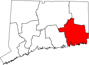
North Stonington, Connecticut
Colonial authorities eventually allotted two reservations to the Pequot tribe, including a plot of land on the eastern bank of Long Pond adjacent to Lantern Hill in the southwestern corner of the town, established in 1683.
The end of hostilities following King Philip's War of 1676 and a partial resolution of border disputes among Connecticut, Rhode Island, and Massachusetts colonies also encouraged enterprising pioneers to move inland to stake claims.
One of those who worked on this project was 16-year-old Silas Deane, who later represented Connecticut during the First and Second Continental Congress and served briefly as one of the United States' first diplomats in France.
One of the main results of this revivalist movement was the rapid growth of the Baptist Church in America, and North Stonington became a bastion of this denomination in Connecticut.
The original building sat a couple miles south of the 1830 church atop Pendleton Hill on land donated by Luther Palmer in the town's northeastern corner.
The primary reason for this was that the town's farmers were no longer focused on clearing land and subsistence cultivation, and were now producing ever-larger crop and livestock yields that could be exported to markets, either in Connecticut or as far away as in Boston and the West Indies.
The communities of Mystic, Stonington Borough, and Pawcatuck were far away—by the standards of the pre-automobile era—and, being of a seafaring nature, the "southerners" possessed significantly different needs and interests.
Efforts by the southern communities from the late 18th century to build a number of relatively expensive construction projects along the coastline, such as a new road from Stonington Borough to Mystic and a bridge over Lambert's Cove, at first led residents of the northern end of the town to oppose budgeting monies for these projects, and eventually caused the northerners to secede and form their own town.
There were 3,335 sheep, a reflection of the prodigious wool business in the town as a result of trade barriers erected by the United States against British textile imports that spurred considerable domestic demand for woolen products.
Two eminent citizens owned chaises: Revolutionary War veteran Elias Sanford Palmer of Pauchunganuc Hill, and Thomas Prentice, who lived in the northwest part of town.
Nine leading citizens, including Elias Sanford Palmer and Thomas Prentice, also possessed another status symbol: clocks with "steel and brass parts".
The first time was in June 1813, when Randall's regiment—which consisted of about 300 men, equally from Stonington and North Stonington—force-marched overnight in driving rain to Groton to help defend the city against a feared landing by British naval forces.
The 30th Regiment returned to the colors again in August 1814, when a squadron of British warships bombarded Stonington Borough in preparation for a raid on the town.
The town's overall population rose from 2,500 shortly after incorporation to over 2,800 by the 1830s, and commercial activity during this period was facilitated by the opening in 1820 of the New London-Providence Turnpike, which today is known as Route 184.
Maj. Dudley Wheeler (1796–1888) was the most prominent member of the family at this time; in addition to owning two stores in town, he also was extensively involved in the wool export business and during mid-century worked out of an import-export office in New York City.
Over the next century, the Wheelers left their mark on the town through a number of legacies including providing large donations to the Congregational Church and the school system.
Main (1805–86) who like Dudley Wheeler established himself as a local businessman and mill owner before moving to New York City to work in various commercial enterprises.
The commercial boom in the town was by no means limited to just a few families, and permitted the construction of many ornate homes in Milltown and elsewhere, many of which have survived to this day.
Adding to North Stonington's decline in population was that an increasing number of the town's youth were joining the wave of migrants heading west to try their fortunes on the frontier.
Out-migration through the late 19th and early 20th centuries ensured that the town's population would remain on a gradual, downward slope, despite the fact that the families still tended to be large.
William S. Hubbel, who enlisted in the regiment from North Stonington, earned the Medal of Honor for capturing a large number of Confederate soldiers while leading a small raiding party in 1864.
The Civil War created a large market for woolen products for the Army, leading to a temporary resurgence in mill activity in North Stonington.
Jumping at the new commercial opportunity, Alfred Clark built a large carding factory to process wool in Burch's Falls, costing him $34,000.
After the Civil War, the population of North Stonington—like most of rural New England—continued to dwindle, so that by 1910, after just over a century since its incorporation, the number of residents stood at only 1,100, less than two-fifths than at the town's height during the mill era.
The town's youth continued to migrate to the big cities to earn their fortunes, or to join the wave of pioneers flocking west to settle the frontier.
Otis Randall, born in 1860 and a scion of one of the town's founding families, become a professor of mathematics at Brown University and was that institution's dean during 1913–1930.
In the early 20th century progress arrived to re-stitch the town economically with the outer world, first in 1906 in the form of a trolley line that traversed North Stonington on its way from Westerly to Norwich.
The establishment of paved highways through the town in the 1920s and 1930s laid the foundation for the rapid population growth and dramatic economic changes wrought after World War II in North Stonington and elsewhere in New London County.
The dramatic growth in the town's population had a direct impact on the size of the school system; whereas in the late 1950s the average graduating class ran in the teens, by 1965 it had more than doubled to 42, and was 51 in 1968.
In 1983 the village was added to the National Register of Historic Places, based on 58 existing homes and other buildings from the late 18th and early 19th centuries within its environs.