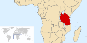
Geography of Tanzania
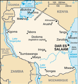
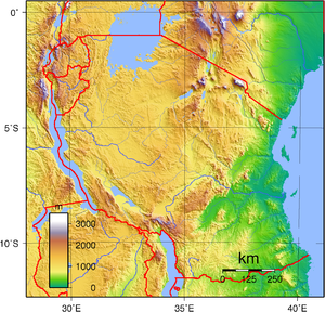
Geographic coordinates: 6°00′S 35°00′E / 6.000°S 35.000°E / -6.000; 35.000 Continent: Africa Area:[2] note: includes the islands of Mafia, Pemba, and Unguja Land boundaries:[2] Coastline: 1,424 kilometres (885 mi)[2] Maritime claims: Terrain: plains along coast; central plateau; highlands in north, south[2] Elevation extremes:[2] Natural resources: hydropower, tin, phosphates, iron ore, coal, diamonds, gemstones, gold, natural gas, nickel[2] Land use: Irrigated land: 1,843 square kilometres (712 sq mi) (2003)[2] Total renewable water resources: 96.27 cubic kilometres (23.10 cu mi) (2011) Natural hazards: Environment - current issues: soil degradation; deforestation; desertification; destruction of coral reef threatens marine habitats; recent droughts affected marginal agriculture; wildlife threatened by illegal hunting and trade, especially for ivory[2] Environment - international agreements:[2] Northeast Tanzania exhibits a mountainous terrain and includes Mount Meru, an active volcano, Mount Kilimanjaro, a dormant volcano, and the Usambara and Pare mountain ranges.
On the floor of the rift are a number of large salt lakes, including Natron in the north, Manyara in the south, and Eyasi in the southwest.
Just to the south of Lake Natron is Ol Doinyo Lengai with an elevation of 3,188 m (10,459 ft),[3] the world's only active volcano to produce natrocarbonatite lava.
To the west of the Crater Highlands lies Serengeti National Park, which is famous for its lions, leopards, elephants, rhinoceroses, and buffalo plus the annual migration of millions of white bearded wildebeest.
The western portion of the country between Lakes Victoria, Tanganyika, and Malawi consists of flat land that has been categorised by the World Wildlife Fund as part of the Central Zambezian miombo woodlands ecoregion.
The southern half of this plateau is grassland within the Eastern miombo woodlands ecoregion, the majority of which is covered by the huge Selous National Park.
The Southern Eastern Rift area of north-central Tanzania is made up of several endorheic basins, which have no outlet to the sea and drain into salt and/or alkaline lakes.
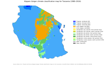
It migrates southwards through Tanzania in October to December, reaching the south of the country in January and February, and returning northwards in March, April, and May.
This causes the north and east of Tanzania to experience two distinct wet periods – the short rains (or "Vuli") in October to December and the long rains (or "Masika") from March to May – while the southern, western, and central parts of the country experience one wet season that continues October through to April or May.