Clutha District
Clutha District has a land area of 6,334.47 km2 (2,445.75 sq mi) and an estimated population of 19,300 as of June 2024.
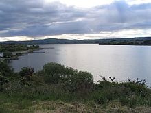
Clutha District occupies the majority of the geographical area known as South Otago.
The two branches of the river (the Matau and the Kouau) form the island of Inch Clutha.
To the south of this is the rough bush country of the Catlins, with its forests and rugged coastline.
The Waipori River, the Taieri's largest tributary, forms the northeastern border of Clutha District.
These were amalgamated into one district authority in 1989 as part of a nationwide reorganisation of local government.
[1] The most populous town in Clutha District is Balclutha, which lies 81 km south of Dunedin by road.
2,270), Kaitangata, Tapanui, Lawrence, Owaka, Stirling, Clinton, Kaka Point, and Benhar.