Colony of Virginia
The first effort to create an English settlement in the area was chartered in 1584 and established in 1585; the resulting Roanoke Colony lasted for three attempts totaling six years.
Jamestown occupied land belonging to the Powhatan Confederacy; it was also on the brink of failure before the arrival of a new group of settlers and supplies by ship in 1610.
"[9][10] On his next voyage, Raleigh learned that while the chief of the Secotans was indeed called Wingina, the expression wingandacoa heard by the English upon arrival actually meant "What good clothes you wear!"
Although Spain, France, Sweden, and the Netherlands all had competing claims to the region, none of these prevented the English from becoming the first European power to colonize successfully the Mid-Atlantic coastline.
On December 20, 1606, he set sail from England with his flagship, the Susan Constant, and two smaller ships, the Godspeed, and the Discovery, with 105 men and boys, plus 39 sailors.
After exploring at least as far upriver as the confluence of the Appomattox River at present-day Hopewell, they returned downstream to Jamestown Island, which offered a favorable defensive position against enemy ships and deep water anchorage adjacent to the land.
They selected a location largely cut off from the mainland with little game for hunting, no natural fresh drinking water, and minimal ground for farming.
Approximately three months later, the group landed on a wooded peninsula where the Kennebec River meets the Atlantic Ocean and began building Fort St. George.
Admiral Somers had the Sea Venture, carrying most of the mission's supplies, deliberately driven aground onto the reefs of Bermuda to avoid sinking.
Combined with drought and hostile relations with the Native Americans, the loss of the supplies that had been aboard the Sea Venture resulted in the Starving Time in late 1609 to May 1610, during which over 80% of the colonists perished.
The king authorized another leader, Thomas West, 3rd Baron De La Warr, later better known as "Lord Delaware", to have greater powers, and the London Company organized another supply mission.
He first sent Thomas Gates to drive off the Kecoughtan from their village on July 9, 1610, then gave Chief Powhatan an ultimatum to either return all English subjects and property, or face war.
Enraged, De la Warr had the hand of a Paspahegh captive cut off and sent him to the paramount chief with another ultimatum: Return all English subjects and property, or the neighboring villages would be burned.
On August 9, 1610, tired of waiting for a response from the Powhatan, West sent George Percy with 70 men to attack the Paspahegh capital, burning the houses and cutting down their cornfields.
Plantations and new outposts sprung up starting with Henricus, initially both upriver and downriver along the navigable portion of the James and thereafter along the other rivers and waterways of the area.
Chief Opechancanough organized and led a well-coordinated series of surprise attacks on multiple English colonial settlements along both sides of a 50-mile (80 km) long stretch of the James River, which took place early on the morning of March 22, 1622.
The massacre caught most of the Virginia Colony by surprise and virtually wiped out several entire communities, including Henricus and Wolstenholme Towne at Martin's Hundred.
Jamestown was spared from destruction because an Indian boy named Chanco learned of the planned attacks from his brother and warned colonist Richard Pace with whom he lived.
A year later, Captain William Tucker and John Pott worked out a truce with the Powhatan and proposed a toast using liquor laced with poison.
Around 500 colonists were killed, but that number represented a relatively low percentage of the overall population, as opposed to the earlier massacre (the 1622 attack had wiped out a third; that of 1644 barely a tenth).
In July, they marched against the Pamunkey, Chickahominy, and Powhatan proper; and south of the James, against the Appomattoc, Weyanoke, Warraskoyak, and Nansemond, as well as two Carolina tribes, the Chowanoke and Secotan.
At the same time, a racial frontier was delineated between Indian and English settlements, with members of each group forbidden to cross to the other side except by a special pass obtained at one of the newly erected border forts.
This dictated that: [D]ue punishment [be] inflicted upon the said Delinquents, do[es] Declare all and every the said persons in Barbada's, Antego, Bermuda's and Virginia, that have contrived, abetted, aided or assisted those horrid Rebellions, or have since willingly joyned with them, to be notorious Robbers and Traitors, and such as by the Law of Nations are not to be permitted any maner of Commerce or Traffique with any people whatsoever; and do[es] forbid to all maner of persons, Foreiners, and others, all maner of Commerce, Traffique and Correspondency whatsoever, to be used or held with the said Rebels in the Barbada's, Bermuda's, Virginia and Antego, or either of them.The act authorized Parliamentary privateers to act against English vessels trading with the rebellious colonies: "All Ships that Trade with the Rebels may be surprized.
The status quo was strongly reinforced by what Thomas Jefferson called "feudal and unnatural distinctions" that were vital to the maintenance of aristocracy in Virginia.
As a result, increasingly large plantations, worked by white tenant farmers and by enslaved Black people, gained in size, wealth, and political power in the eastern ("Tidewater") tobacco areas.
By this time, the colonists were exporting 50,000 pounds of tobacco to England per year and were beginning to generate enough profit to ensure the economic survival of the colony.
Elizabeth Cittie, known initially as Kecoughtan (a Native word with many variations in spelling by the English), also included the areas now known as South Hampton Roads and the Eastern Shore.
In 1632, the Virginia legislature voted to build a fort to link Jamestown and the York River settlement of Chiskiack and protect the colony from Indian attacks.
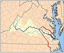
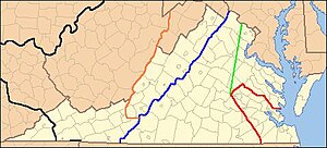
While under the jurisdiction of the Virginia Colony, the proprietary maintained complete control of the granting of land within that territory (and revenues obtained from it) until after the American Revolution.
Due to ambiguities of the text of the various grants causing disputes between the proprietary and the colonial government, the tract was finally demarcated via the Fairfax Line in 1746.