Cook Strait
A number of ships have been wrecked in Cook Strait with significant loss of life, such as the Maria in 1851,[6] the City of Dunedin in 1865,[7] the St Vincent in 1869,[6] the Lastingham in 1884,[8] SS Penguin in 1909[9] and TEV Wahine in 1968.
Kupe followed in his canoe a monstrous octopus called Te Wheke-a-Muturangi across Cook Strait and destroyed it in Tory Channel or at Pātea.
When Dutch explorer Abel Tasman first saw New Zealand in 1642, he thought Cook Strait was a bight closed to the east.
Between 1888 and 1912 a Risso's dolphin named Pelorus Jack became famous for meeting and escorting ships around Cook Strait.
Pelorus Jack was usually spotted in Admiralty Bay between Cape Francis and Collinet Point, near French Pass, a channel used by ships travelling between Wellington and Nelson.
In addition thirteen 15 cm (6 in) gun installations were constructed around Wellington, along the Mākara coast, and at entrances to the Marlborough Sounds.
Approximately 18,000 years ago during the Last Glacial Maximum when sea levels were over 100 metres (330 feet) lower than present day levels, Cook Strait was a deep harbour of the Pacific Ocean, disconnected from the Tasman Sea by the vast coastal plains which formed at the South Taranaki Bight which connected the North and South islands.
To the east is the Cook Strait Canyon with steep walls descending eastwards into the bathyal depths of the Hikurangi Trough.
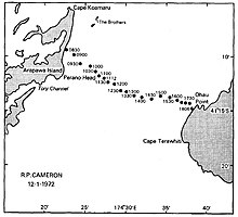
Fisherman's Rock in the north end of the Narrows Basin rises to within a few metres of low tide, and is marked by waves breaking in rough weather.
[17] This is because the main M2 lunar tide component that happens about twice per day (actually 12.42 hours)[18] circulates anti-clockwise around New Zealand, and is out of phase at each end of the strait (see animation on the right).
He produced a number of studies including analysis of tides [23] which identified the presence of a "virtual amphidrome" in the region.
[27] The substantial levels of turbulence have been compared to that observed in the Straits of Gibraltar and Seymour Narrows in British Columbia.
The famous Pelorus Jack was a Risso's dolphin being observed escorting the ships between 1888 and 1912, though this species is not a common visitor to the New Zealand's waters.
Currently, an annual survey of counting humpback whales is taken by Department of Conservation and former whalers help DOC to spot animals by using several vantage points along the strait such as on Stephens Island.
Giant squid specimens have been washed ashore around Cook Strait or found in the stomachs of sperm whales off Kaikōura.
A colony of male fur seals has long been established near Pariwhero / Red Rocks on the south Wellington coast.
[30] Regular ferry services run between Picton in the Marlborough Sounds and Wellington, operated by KiwiRail (the Interislander) and StraitNZ (Bluebridge).
New Zealand's position directly athwart the roaring forties means that the strait funnels westerly winds and deflects them into northerlies.
As a result, ferry sailings are often disrupted and Cook Strait is regarded as one of the most dangerous and unpredictable waters in the world.
[citation needed] In 1962 the first ferry service to allow railway carriages, cars and trucks began with GMV Aramoana.
[33] On 16 February 1986 the cruise ship Mikhail Lermontov struck rocks at Cape Jackson at the northern tip of the Marlborough Sounds and sank in Port Gore, with one person killed.
[34] In 2006, 14-metre (46 ft) waves resulted in the Interislander ferry DEV Aratere slewing violently and heeling to 50 degrees.
Three passengers and a crew member were injured, five rail wagons were toppled and many trucks and cars were heavily damaged.
Maritime NZ's expert witness Gordon Wood claimed that if the ferry had capsized most passengers and crew would have been trapped inside and would have had no warning or time to put on lifejackets.
[45] In 2021 the first electric aircraft flight across Cook Strait, from Omaka Aerodrome to Wellington Airport, by Gary Freedman in a Pipistrel Alpha Electro.
[48][49] In 1879 the vessel Kangaroo laid a further 120-nautical-mile-long (220 km) telegraph cable across Cook Strait from Whanganui to Wakapuaka, near Nelson.
[50] Electric power and communication cables link the North and South Islands across Cook Strait, operated by Transpower.
[52] In April 2008, Neptune Power was granted a resource consent to install a $10 million experimental underwater tidal stream turbine capable of producing one megawatt.
The company claimed there is enough tidal movement in Cook Strait to generate 12 GW of power, more than one-and-a-half times New Zealand's current requirements.
The company claimed that Tory Channel was an optimal site with a tidal current speed of 3.6 metres per second (12 ft/s) and the best combination of bathymetry and accessibility to the electricity network.