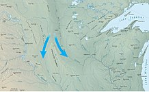
Coteau des Prairies
is a plateau approximately 200 miles in length and 100 miles in width (320 by 160 km), rising from the prairie flatlands in eastern South Dakota, southwestern Minnesota, and northwestern Iowa in the United States.
The southeast portion of the Coteau comprises one of the distinct regions of Minnesota, known as Buffalo Ridge.
The flatiron-shaped plateau was named by early French explorers from New France (Quebec), coteau meaning "hill" in French; the general term coteau has since been used in English to describe any upland dividing ridge.
Pipestone deposits on the plateau have been quarried for hundreds of years by Native Americans, who use the prized, brownish-red mineral to make their sacred ceremonial pipes.
The quarries are located at Pipestone National Monument in the southwest corner of Minnesota and in adjacent Minnehaha County, South Dakota.