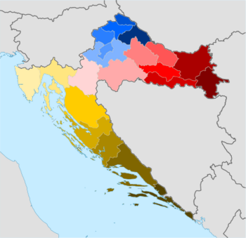
Counties of Croatia
Administrative departments and services are managed by heads (principals) nominated by the county prefect based on a public competition.
[9][10] The counties are tasked with performing general public administration services, primary and secondary education, government funded healthcare, social welfare, administration pertaining to agriculture, forestry, hunting, fisheries, mining, industry and construction, and other services to the economy at the county level, as well as road transport infrastructure management and issuing of building and location permits and other documents concerning construction in the county area excluding the area of the big city and the county seat city; the central government and local (city and municipal) governments may also perform each of those tasks at their respective levels according to the law.
Approximately one half of the total spent by the counties is channeled into their primary fields of competence – secondary and vocational education, and financing of maintenance and running costs of healthcare and social welfare institutions.
The criticism primarily stems from the fact that the counties receive the bulk of the funds needed for specific purposes from the central government budget and transfers them on.
[13] After year 2000, all those considerations have contributed to an ongoing debate in Croatia on the need of consolidation or abolition of the counties in political forums.
[17] Medieval Croatia under the House of Trpimirović was territorially organised for purposes of administration into areas named župa.
Gradually, the term župa was replaced in practice with županija – meaning "the territory governed by a župan.
[20] There are indications that there were further contemporary counties in Lower Pannonia north of Gvozd Mountain (referred to as the Pannonian Croatia in some sources) in the same period.
[21] In the area between the Kvarner Gulf of the Adriatic Sea, the Mala Kapela mountain, and the rivers of Kupa and Korana, there was the Modruš County in existence in the late 11th century.
[24] Just as the Vrbas, Sana, and Dubica counties, sources locate the Glaž County to the northwestern Bosnia, but disagree on its location, placing it around the Ukrina river or, like historian Pál Engel, equating its seat Glaž [hr] with the city of Banja Luka.
[32] The Vrbas, Sana and Dubica counties also existed until the Ottoman conquest,[33] while Glaž was last mentioned in preserved historical records in 1469.
The gradual decline of importance of the counties, already present before the Habsburg era, continued as the Ottoman threat increased.
His duties were discharged through two deputies for judiciary and administration respectively, judges, as well as other professionals such as lawyers, physicians, engineers, tax collectors, etc.
Its coastal areas extending from Fiume (modern-day Rijeka) to Senj to form the Hungarian Littoral, while the remainder was added to the Zagreb County.
However, the Hungarian Littoral was abolished and the legal Corups separatum was carved out of Fiume and its immediate surroundings to be ruled directly by Hungary, while the remainder of the Rijeka County (also referred to as the Croatian Littoral) was a part of the Kingdom of Croatia-Slavonia – itself a product of merger of Croatia and Slavonia, consisting of seven counties after the settlement.
[37] In 1871, the Varaždin Generalate of the Croatian Military Frontier was abolished by the central authorities of the recently established Austria-Hungary and the bulk of the Bjelovar County spanning the territory previously under military control between the kingdoms of Croatia and Slavonia and including the cities of Bjelovar (as the county capital) and Ivanić Grad.
[45] The traditional division of Croatia into counties was abolished in 1922, when the oblasts of the Kingdom of Serbs, Croats and Slovenes were introduced; these were later replaced by the banovinas of Yugoslavia.
[47] Socialist Republic of Croatia, as a constituent part of post-World War II Yugoslavia had approximately 100 municipalities as main governmental units and local government entities.
[48][49] The county borders have sometimes changed since their 1992 restoration (for reasons such as historical ties and requests by cities); the latest revision took place in 2006.
[4] After the end of the Croatian War of Independence and during the UNTAES process in eastern Croatia, local Serb population and representatives unsuccessfully proposed various initiatives to preserve the former rebel region as one territorial unit within Croatia, including the proposal to create a new "Serb county" in the region.
[50] Present-day counties correspond to the 2021 classification of tier three of the European Union NUTS statistical regions of Croatia.