List of county roads in Citrus County, Florida
Before North Apopka Avenue continues to the boat ramp named for the street,[4] CR 470 leaves to the northeast at East Vine Street, and eventually turns onto East Gospel Island Trail, where it immediately crosses the Franklin Hair Bridge to reach the island the road was named after.
The route doesn't leave the island until the bridge east of North Shadow Wood Drive, and then curves slightly to the northeast.
West Miss Maggie Drive curves back to the northeast one block later, and follows the southern shores of the Chassahowitzka River wetlands.
0.1 of a mile east of West Lykes Trail, the road makes a slight curve to the left, but still continues to run northeast and southwest.
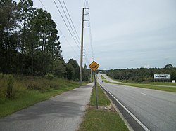
After crossing one last power line, County Road 480 ends at US 41 south of Floral City, with turning ramps on the northwest and southwest corners of the intersection.
County Road 482 runs exclusively along West Cardinal Street from US 19/98 in Homosassa to Citrus CR 491 (Lecanto Highway) near the site of the ghost town of Mannfield.
[1] County Road 486 is four lanes wide, and almost entirely a divided highway, that is flanked by a parallel bicycle path on the south side.
The first intersection along East Norvelle Bryant Highway is the gateway to The Villages of Citrus Hills, but only after passing a nearby hotel on the south side of the road.
County Road 490 officially begins at the Duncan J. McRae Public Boat Ramp along the Homossassa River at the northwest end of South Cherokee Way.
Briefly curving to the north at West Central Street and then northeast, it passes through the Yulee Sugar Mill Ruins Historic State Park.
The road almost continues to the northeast along West Fishbowl Drive, but then moves to the east again, and curves through the woodlands centered around the sugar mill.
Taking a northeast turn, it branches off to the left at West Bradshaw Street, which curves to the southeast ending at US 19–98 (Suncoast Boulevard).
US 19/98/CR 490 passes by the Homosassa Springs Wildlife State Park, and then encounters an intersection with both CR 490A (See below), and West Grover Cleveland Boulevard.
Aside from entrances to trailer parks and deed restricted communities, most of the structures along this often hilly segment of CR 490 consist of local businesses, billboards, and churches.
[8] Citrus County Road 490 finally ends at SR 44 in Lecanto at a point along that route where it runs from southeast to east.
The road widens once again and this time turns into a divided highwaybefore it approaches CR 486, also known as West Norvelle Bryant Highway.
The first major intersection in this community is at West Roosevelt Boulevard and North Modelwood Drive, the former of which is the first gateway through Beverly Hills.
The divided highway ends as the road begins to narrow, but not before intersecting the northern terminus of a second Beverly Hill gateway known as Forest Ridge Boulevard.
The road curves slightly to the east before it approaches the south end of North Lecanto Highway, a gateway road to Citrus Springs, then approaches the Sandy Oaks RV Resort near the power line ROW leading from the former Crystal River 3 Nuclear Power Plant, and after this the gateway to Central Ridge District Park,[11] before the road turns straight east and enters Holder, where it passes the Withlacoochee State Trail trailheads two blocks before intersecting US 41, which up until the Autumn of 2010 was a blinker-light intersection that was replaced as a normal signalized intersection.
The road takes a slight curve before approaching the same power lines it crossed west of Holder, and returns to the northeast once again.
It runs east and west from Sunny Isles Estates on the Gulf of Mexico to US 19–98 in Ozello, south of Crystal River.
The last intersection providing a connection between US 19–98 at Crystal River Mall and SR 44 is a street named Turkey Oak Drive.
After passing some residential dead end streets it runs under a power line right of way near the site of the proposed interchange with Suncoast Parkway.
The route continues north of CR 488 passing a local bar, a Citrus County fire house, and a small industrial area, but eventually becomes primarily residential, mixed with some sparse farm and ranch land.
Curving to the northeast north of West Glendale Court, the road momentarily runs close to Lake Rousseau, but the view of the water is obstructed by woodlands, and later a farm field.
It runs south to north from the Hernando-Citrus County Line to a dead end at the Withlacoochee River, northeast of Inverness.
The route was formerly designated at SR 581,[1] and the connection to SR/CR 581 in southern Hernando, Pasco and Hillsborough Counties was severed by the renumbering of Snow Memorial Highway as CR 481.
Like its Hernando County counterpart, it runs through local farm and ranch land with the occasional private dirt road intersection.
North of East Triss Street, the route encounters more local businesses before serving as the location of the Shiridi Sai Hindu Temple,[13] a rare landmark of eastern culture in rural Florida.
[14] Just north of the church, the route intersects East Haven Street and Druid Road, the latter of which leads to a Citrus County Library.